HRSC nadir image of Tractus Catena

HRSC nadir image of Tractus Catena
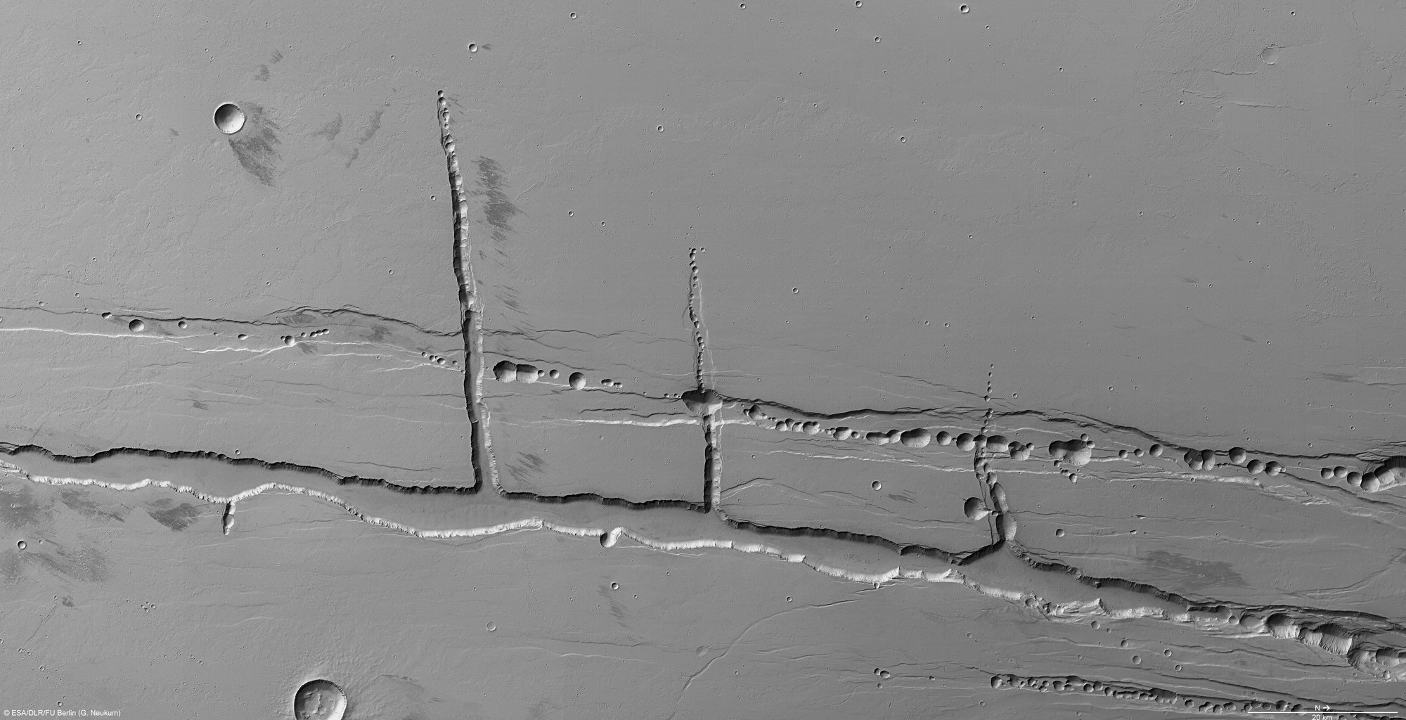
The nadir channel, which is directed vertically down onto the surface, has the highest resolution of the HRSC camera system. In this case, as Mars Express flew over the northern Tharsis highlands at an altitude of slightly over 400 kilometres, the resulting resolution is 20 metres per pixel. This enables small-scale geological structures to be identified; north is to the right in the image. The image section shown covers an area of roughly 190 by 100 kilometres. Numerous, circular crater-like depressions aligned with one another resembling a string of pearls – a pit crater chain – are visible along two main fault lines parallel to one another. The high image resolution enables the structures on the rims of the stress fractures and the separate pits to be made out very easily. Various geological processes are being discussed as the origin of the pit crater chains.
Copyright note:
As a joint undertaking by DLR, ESA and FU Berlin, the Mars Express HRSC images are published under a Creative Commons licence since December 2014: ESA/DLR/FU Berlin, CC BY-SA 3.0 IGO. This licence will also apply to all HRSC images released to date.