Plan view of the north of the Tempe Terra region

Plan view of the north of the Tempe Terra region
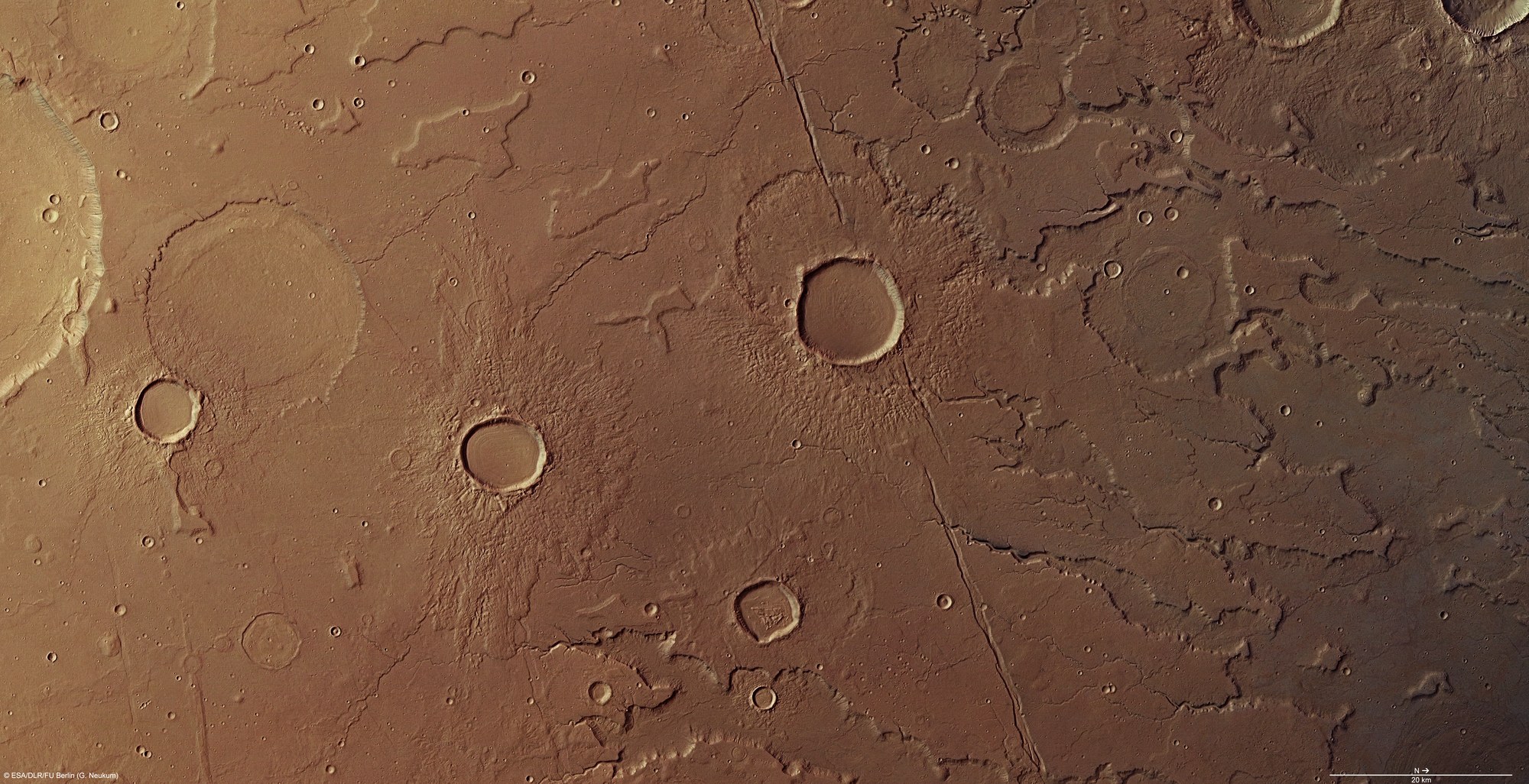
This colour view has been created using the nadir channel, which is directed vertically down onto the Martian surface, and the colour channels of the HRSC camera system on board ESA's Mars Express spacecraft; north is to the right in the image. The image covers an area of over 14,000 square kilometres, equivalent to an area roughly the size of the Bahamas. Tempe Terra is one of the most geologically interesting areas on Mars, because in this transition zone between the highlands and northern lowlands both tectonic forces and water and ice have made a wide range of changes to the landscape.
Copyright note:
As a joint undertaking by DLR, ESA and FU Berlin, the Mars Express HRSC images are published under a Creative Commons licence since December 2014: ESA/DLR/FU Berlin, CC BY-SA 3.0 IGO. This licence will also apply to all HRSC images released to date.