TanDEM-X has completely captured the Earth - strip by strip

TanDEM-X has completely captured the Earth - strip by strip
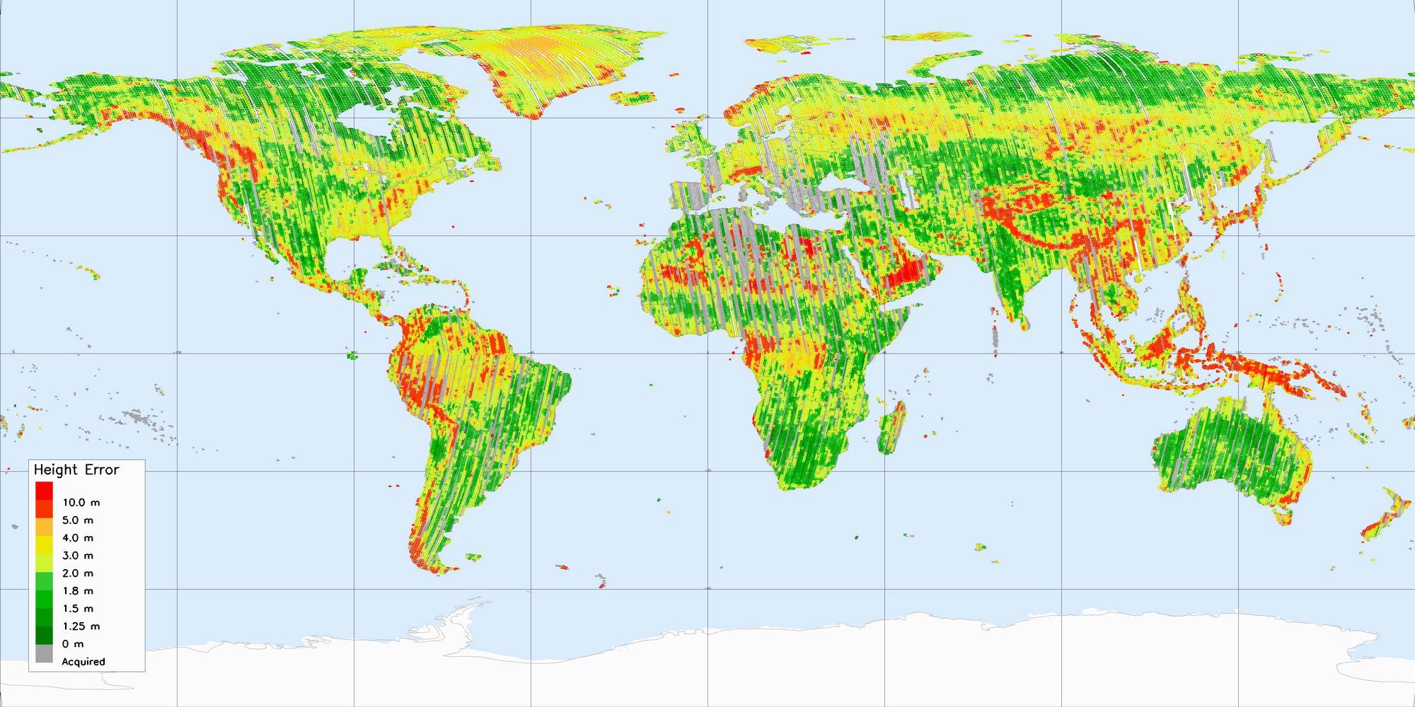
A year after the initial operational phase, TanDEM-X has mapped all land surfaces on earth except Antarctica completely. Elevation models have been generated with the data. According to the color scale, green tinted areas already comply with a the requirement of a two-metre accuracy. Yellow-coloured areas must be recorded a second time, reddish surfaces also require recording from a different angle. Gray-shaded strips have been recorded, but have yet to be processed.