Topographic map of a section of Ius Chasma

Topographic map of a section of Ius Chasma
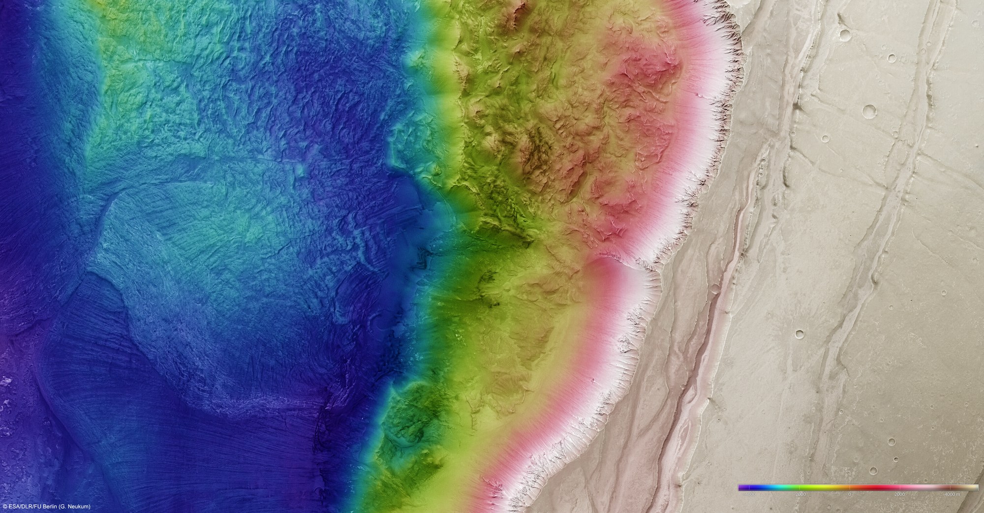
Digital terrain models that illustrate the topography of the region using false colours can be derived using the HRSC stereo camera. The altitude can be read from the colour scale at the bottom right; north is to the right. In the absence of 'sea level', the elevation data is referenced to an areoid - a modelled equipotential surface on which everything experiences the same gravitational attraction towards the centre of the planet. While the valley floor of Ius Chasma is 4000 metres below the areoid, the level of the surrounding Martian highlands is more than 4000 metres above the reference surface – over a horizontal distance of less than 20 kilometres, there is a drop of more than eight kilometres.
Copyright note:
As a joint undertaking by DLR, ESA and FU Berlin, the Mars Express HRSC images are published under a Creative Commons licence since December 2014: ESA/DLR/FU Berlin, CC BY-SA 3.0 IGO. This licence will also apply to all HRSC images released to date.