Topographic map of the western part of Valles Marineris

Topographic map of the western part of Valles Marineris
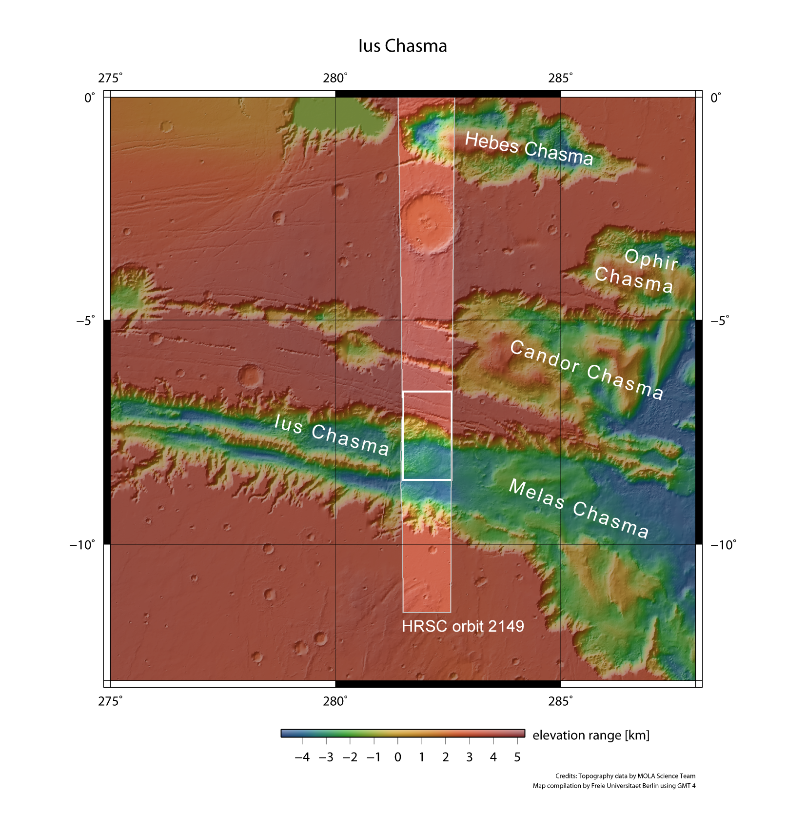
Ius Chasma forms the northern boundary of the western half of the Valles Marineris canyon system; it is almost 1000 kilometres long. The Martian highlands descend about eight kilometres to the floor of Ius Chasma over a steep scarp. ESA’s Mars Express spacecraft has flown over Ius Chasma many times; the images shown here are of the area in the small, inner rectangle. They were acquired during orbit 2149, which took place on 16 September 2005.