Topographic map of Tractus Catena

Topographic map of Tractus Catena
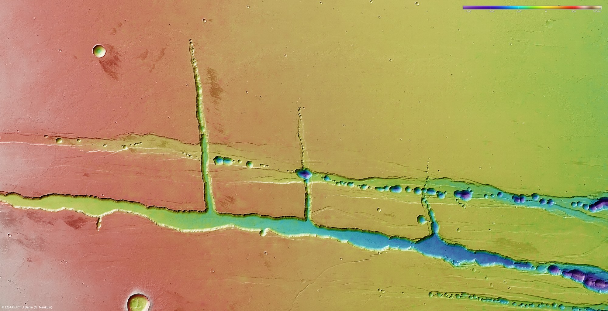
Using the HRSC stereo camera, digital terrain models can be derived that illustrate the topography of the region using false colours. The elevation can be read from a colour scale at the upper right; north is to the right in the image. In the absence of 'sea level', the elevation data is referenced to an areoid – a modelled equipotential surface on which everything experiences the same gravitational attraction towards the centre of the planet. The Tharsis plateau slopes gently towards the north, which is from left to right in the image. The two main faults, stress fractures running linearly from south to north, have a rather similar negative south-north gradient. Numerous, round, crater-like depressions, aligned like a string of pearls and between 1000 and 1500 metres deep, are visible in the northern part of the faults. The origin of these pit crater chains is not yet fully understood.
Copyright note:
As a joint undertaking by DLR, ESA and FU Berlin, the Mars Express HRSC images are published under a Creative Commons licence since December 2014: ESA/DLR/FU Berlin, CC BY-SA 3.0 IGO. This licence will also apply to all HRSC images released to date.