Topographical image map of an area in the eastern part of Syrtis Major

Topographical image map of an area in the eastern part of Syrtis Major
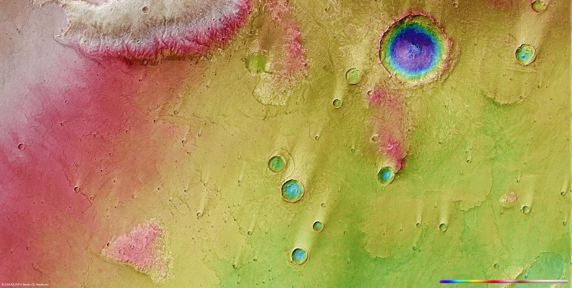
Digital terrain models can be generated using data acquired by several of the nine channels of the High Resolution Stereo Camera (HRSC) on ESA's Mars Express spacecraft, which image the planetary surface from different angles. The use of false colours enables the topography to be pictorially represented – the elevation scale is on the lower right; north is to the right of the image. In the absence of 'sea level', the elevation data is referenced to an areoid – a modelled equipotential surface on which everything experiences the same gravitational attraction towards the centre of the planet.
The volcanic plain progressively rises more than 2000 metres in a southerly direction (left) towards the Martian highlands, forming a ramp several hundred kilometres wide. What look like turquoise green ‘bull’s eyes’ on the plain are in fact impact craters that formed after the end of the volcanism phase. Visible in the right upper quadrant is the floor of a crater about 20 kilometres in diameter; although it lies significantly lower than the volcanic plain formed by the lava flows, its high wall prevented lava from flowing inside and filling the crater.
Copyright note:
As a joint undertaking by DLR, ESA and FU Berlin, the Mars Express HRSC images are published under a Creative Commons licence since December 2014: ESA/DLR/FU Berlin, CC BY-SA 3.0 IGO. This licence will also apply to all HRSC images released to date.