Colour overhead view of the western edge of Acidalia Planitia

Colour overhead view of the western edge of Acidalia Planitia
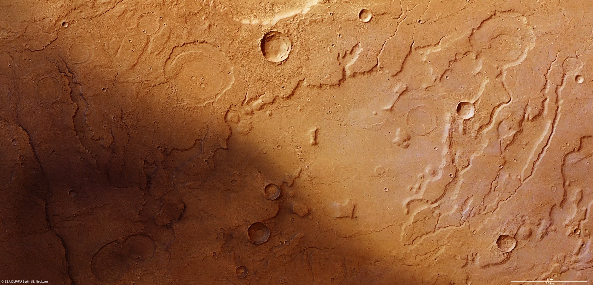
This colour view was created using the nadir channel, which is directed vertically down onto the Martian surface, and the HRSC camera system colour channels on ESA's Mars Express spacecraft; north is to the right in the image. The image section shown here covers an area of around 11,000 square kilometres.
Numerous river valleys can be made out in this section of the transition zone between the Tempe Terra region in the Martian highlands and the northern lowlands of Acidalia Planitia. The dendritic pattern of these river valleys suggests that these structures formed a long time ago by surface water, which presumably precipitated onto Mars in the form of rain or snow. Many of the large craters are filled with sediment that the water transported into these impact structures, which were once much deeper.
Copyright note:
As a joint undertaking by DLR, ESA and FU Berlin, the Mars Express HRSC images are published under a Creative Commons licence since December 2014: ESA/DLR/FU Berlin, CC BY-SA 3.0 IGO. This licence will also apply to all HRSC images released to date.