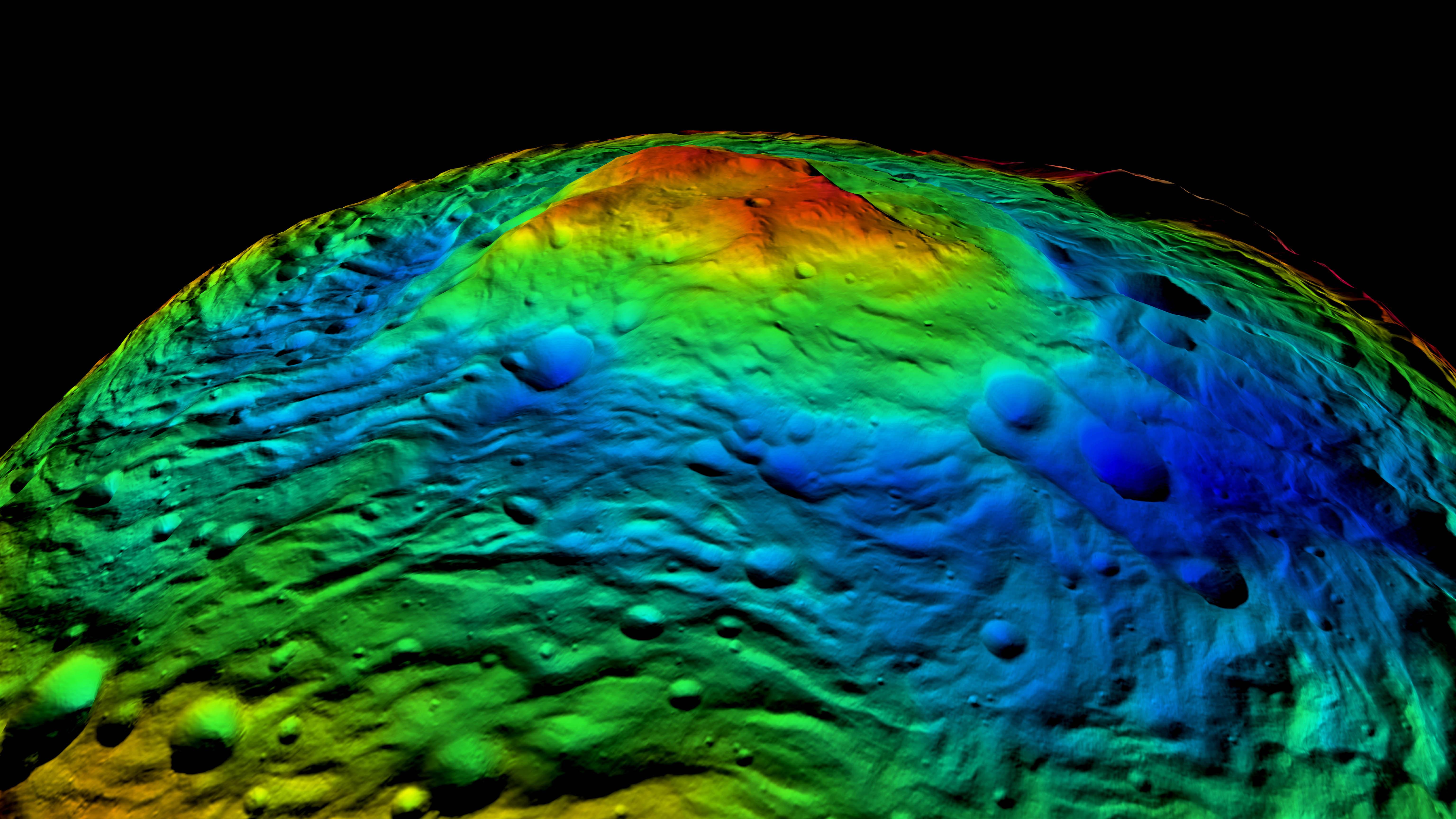
The Rheasilvia impact basin on Vesta's south pole
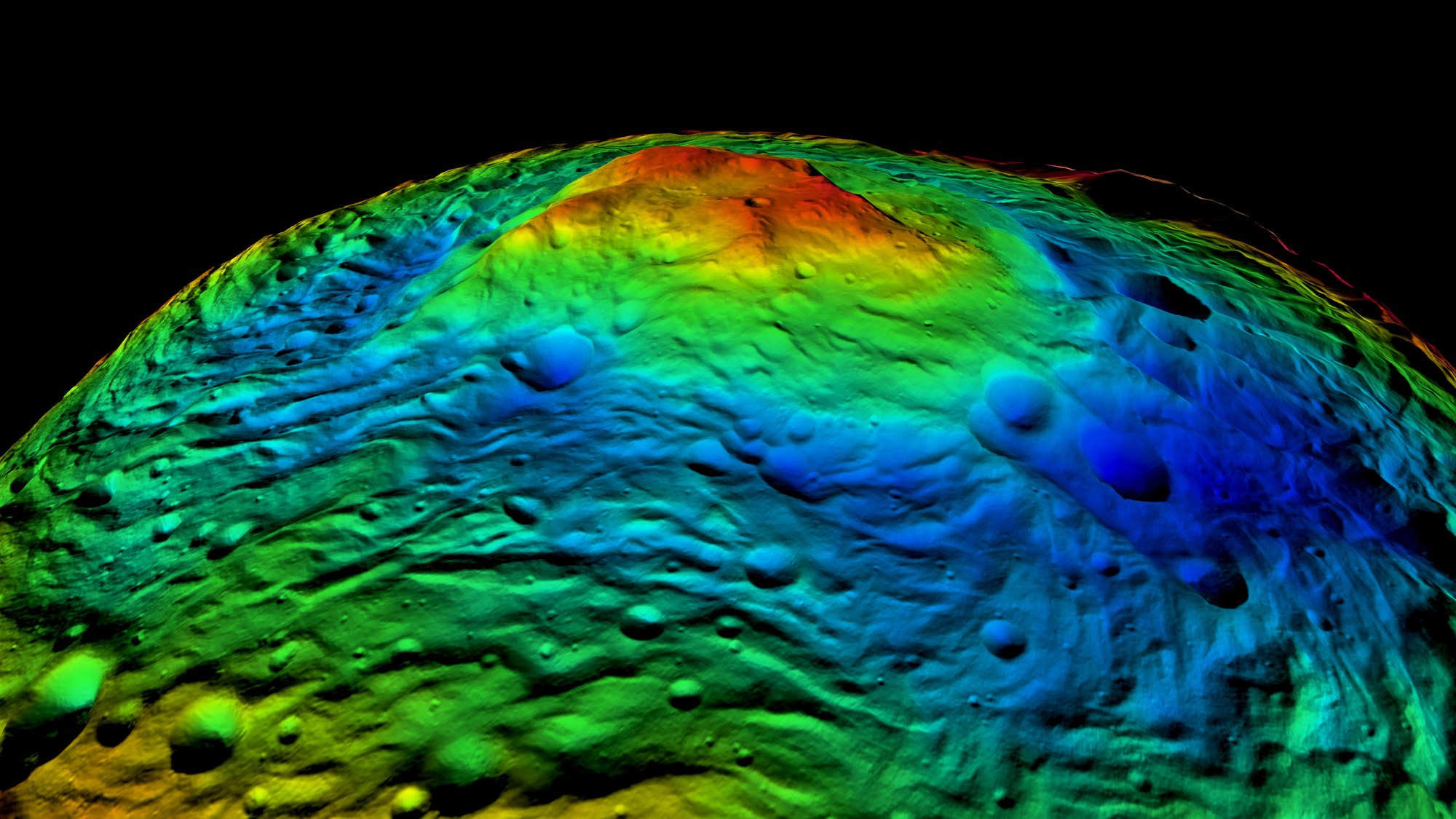

The Rheasilvia impact basin on Vesta's south pole
This false colour topographic map of Vesta's south pole shows parts of the 500-kilometre Rheasilvia impact basin in shades of blue. In the centre of the structure is a striking 20-kilometre high mountain shown in green, yellow and red tones. The global surface topographic model of Vesta was generated by DLR scientists using thousands of individual images through stereo photogrammetry.