Topographic map of Ladon Valles and the craters Sigli and Shambe

Topographic map of Ladon Valles and the craters Sigli and Shambe
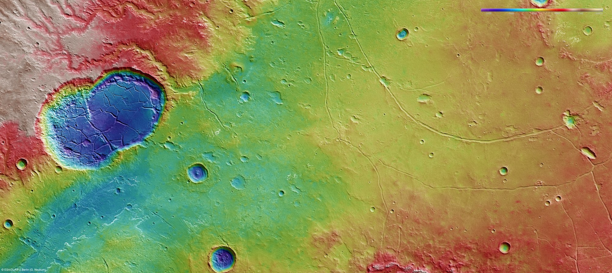
In this image we can see numerous signs that, during an early period of Mars' history, water flowed both in the lowlands of an ancient, already heavily eroded impact basin that Ladon Valles opens out to (lower left), and in the adjacent uplands. In the elevated areas in the southeast (top left), meandering river beds have been carved. The two deep, overlapping craters Sigli and Shambe (left) were filled with standing water. Using the High Resolution Stereo Camera (HRSC), digital terrain models can be derived that illustrate the topography of the region using false colours. The altitudes can be read from the coloured scale at the top right of the full image. In the absence of ‘sea level', the elevation data is referenced to an areoid – a modelled equipotential surface on which everything experiences the same gravitational attraction towards the centre of the planet. The area shown is about 225 by 100 kilometres.
Copyright note:
As a joint undertaking by DLR, ESA and FU Berlin, the Mars Express HRSC images are published under a Creative Commons licence since December 2014: ESA/DLR/FU Berlin, CC BY-SA 3.0 IGO. This licence will also apply to all HRSC images released to date.