Colour plan view of the southeastern Charitum Montes

Colour plan view of the southeastern Charitum Montes
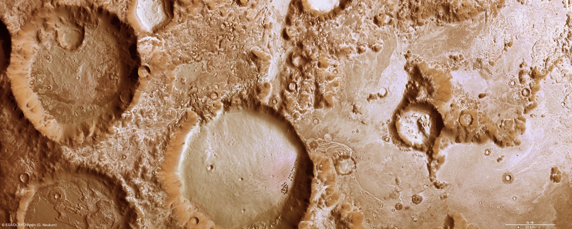
This colour plan view was created using the nadir channel, which is directed vertically down onto the Martian surface, and the colour channels of the High Resolution Stereo Camera (HRSC) on board ESA's Mars Express spacecraft; the resolution is 20 metres per pixel. Charitum Montes runs through the Martian highlands, parallel to the southern edge of the Argyre impact basin. Numerous craters of different sizes are immediately apparent. This is an unmistakeable sign that the major structures of the landscape are very old, probably more than three billion years.
Copyright note:
As a joint undertaking by DLR, ESA and FU Berlin, the Mars Express HRSC images are published under a Creative Commons licence since December 2014: ESA/DLR/FU Berlin, CC BY-SA 3.0 IGO. This licence will also apply to all HRSC images released to date.