Topography of the lower reaches of Kasei Valles

Topography of the lower reaches of Kasei Valles
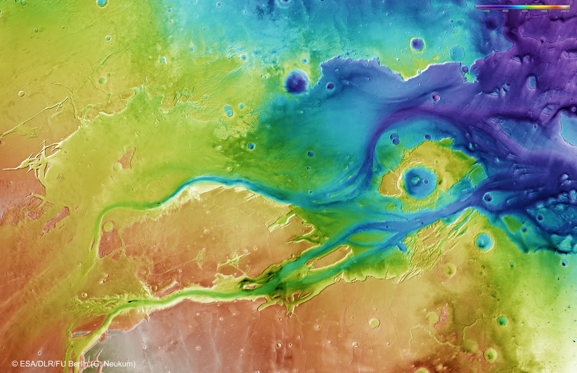
This colour-coded image map shows the topography in the lower reaches of Kasei Valles, divided into numerous separate channels, and the enormous delta region. The area shown extends some 1500 kilometres from east to west, and over 1000 kilometres from north to south. The altitude difference from the highland in the southwest (bottom left) to the western edge of Chryse Planitia (right in the image) is around 8000 metres. It is easy to see how these valleys were carved deep into the highland of Tempe Terrae (top) and Lunae Planum by catastrophic flood events.
Such topographic models of the surface of Mars can be derived from stereo image data acquired by DLR's HRSC camera on board ESA's Mars Express spacecraft. To create this elevation model, 67 individual HRSC image strips were combined into a mosaic.
Copyright note:
As a joint undertaking by DLR, ESA and FU Berlin, the Mars Express HRSC images are published under a Creative Commons licence since December 2014: ESA/DLR/FU Berlin, CC BY-SA 3.0 IGO. This licence will also apply to all HRSC images released to date.