Colour-coded topographical map of the north of Hesperia Planum


Colour-coded topographical map of the north of Hesperia Planum
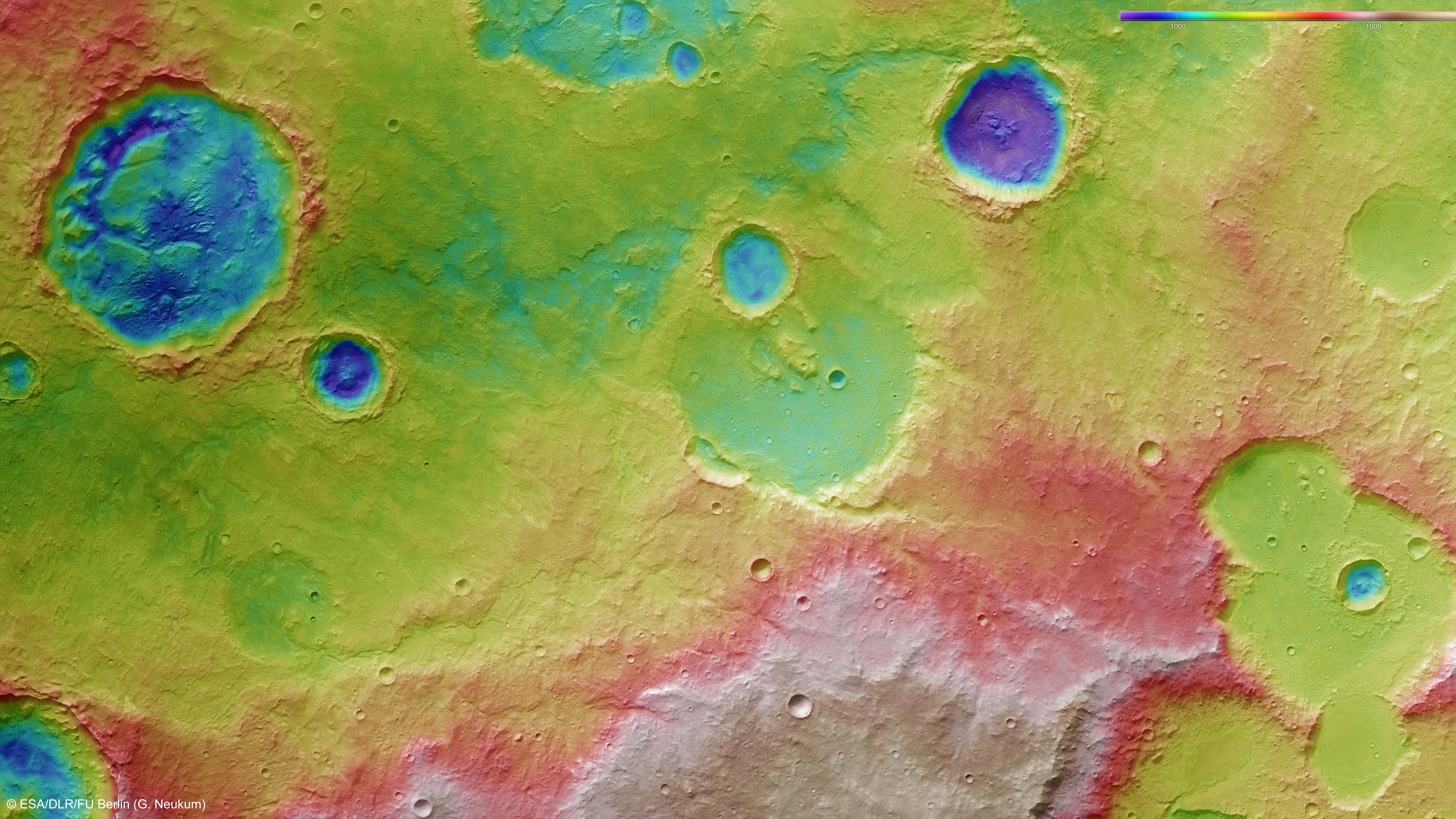
Using the image data from the stereo channels in the HRSC camera system, digital terrain models of the Martian surface can be derived in which the topography can be seen using false colours. The altitude allocation can be read from a colour scale at upper right. In the absence of 'sea level', the elevation data is referenced to an areoid – a modelled equipotential surface on which everything experiences the same gravitational attraction towards the centre of the planet. North is to the right in the image. In this picture, the former course of Tagus Valles can just be seen, rising to the south of the region shown here (outside the image border), and passing above the centre of the image as a meandering valley a few hundred metres deep. The effects of erosion processes on the landscape can easily be seen in the interior of a 34-kilometre-wide crater (upper left in the image).
Copyright note:
As a joint undertaking by DLR, ESA and FU Berlin, the Mars Express HRSC images are published under a Creative Commons licence since December 2014: ESA/DLR/FU Berlin, CC BY-SA 3.0 IGO. This licence will also apply to all HRSC images released to date.