Topographic image map of the southeast edge of the Olympus Mons

Topographic image map of the southeast edge of the Olympus Mons
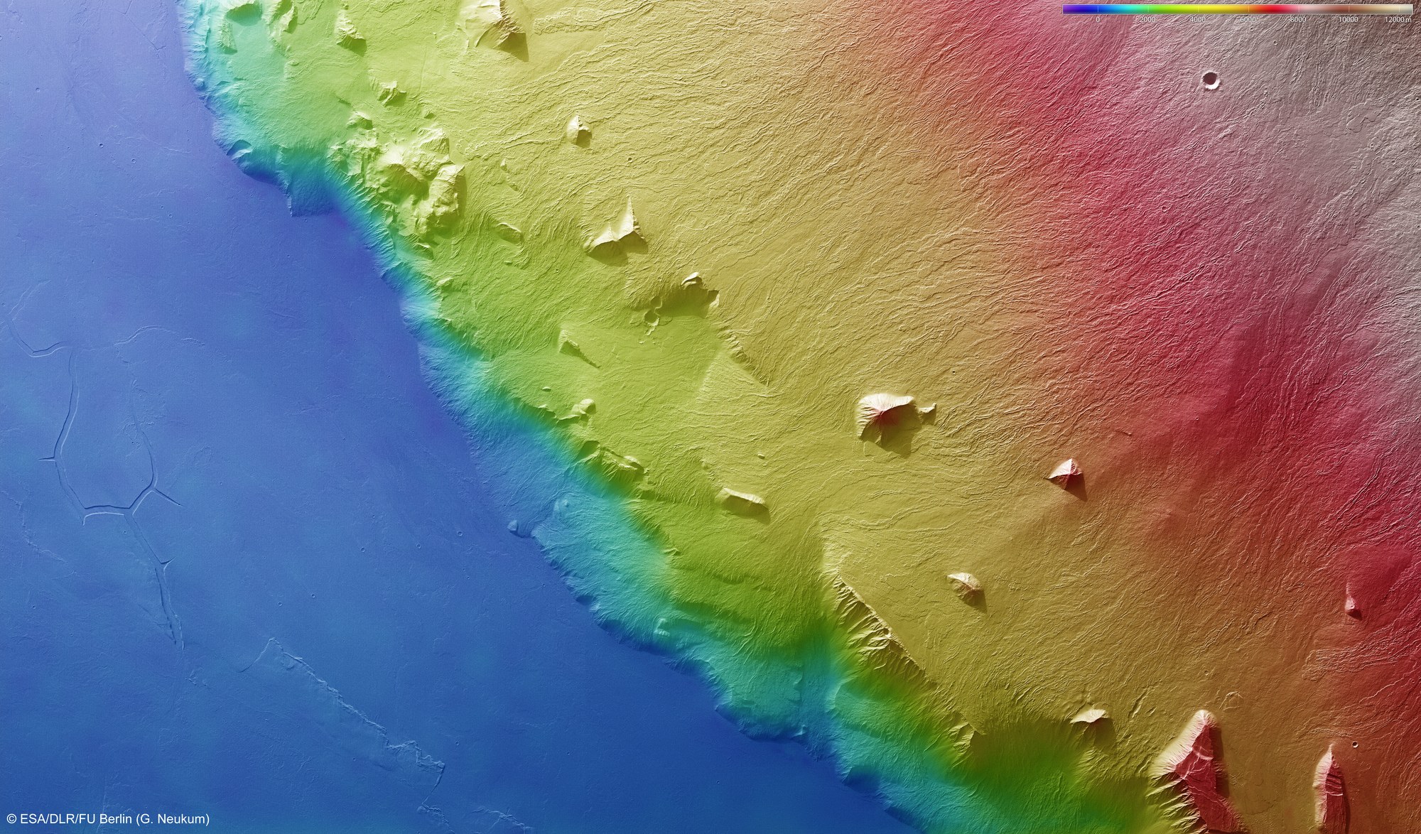
Using the HRSC stereo camera, digital terrain models can be derived that illustrate the topography of the region using false colours. The altitude allocation can be read from a colour scale at top; north is to the right in the image. In the absence of 'sea level', the elevation data is referenced to an areoid – a modelled equipotential surface on which everything experiences the same gravitational attraction towards the centre of the planet. The prominent five to six kilometre high scarp of Olympus Mons, with a slope inclination of about 20 degrees is particularly easy to see in this view.
Copyright note:
As a joint undertaking by DLR, ESA and FU Berlin, the Mars Express HRSC images are published under a Creative Commons licence since December 2014: ESA/DLR/FU Berlin, CC BY-SA 3.0 IGO. This licence will also apply to all HRSC images released to date.