Topographical image map of Becquerel Crater
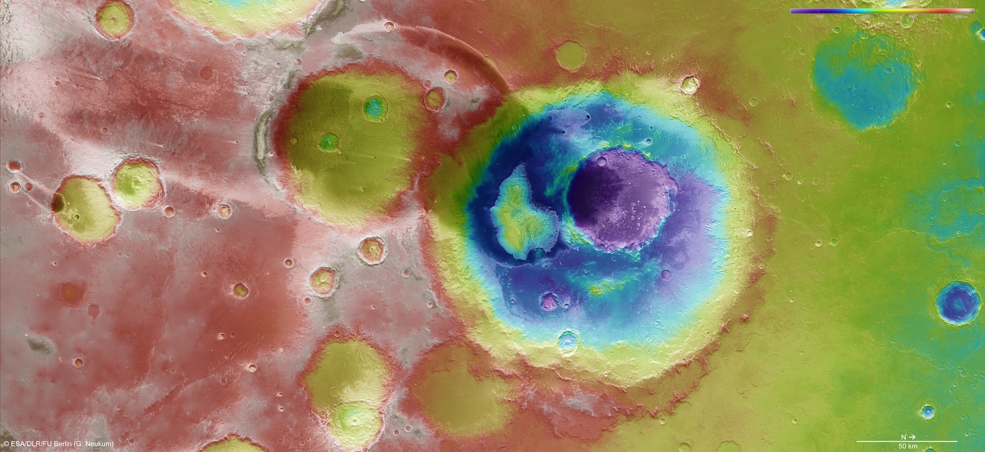

Topographical image map of Becquerel Crater
HRSC stereo image data can be used to calculate topographical terrain models, from which the altitude above or below the reference plane (areoid) of every point shown can be derived. In the absence of 'sea level', the elevation data is referenced to an areoid – a modelled equipotential surface on which everything experiences the same gravitational attraction towards the centre of the planet. Hence, the Arabia Terra region (red and green areas) lies 4000 to 5500 metres below the areoid, and the deepest parts of Becquerel Crater (dark blue) are as much as 7000 metres below the areoid.
Copyright note:
As a joint undertaking by DLR, ESA and FU Berlin, the Mars Express HRSC images are published under a Creative Commons licence since December 2014: ESA/DLR/FU Berlin, CC BY-SA 3.0 IGO. This licence will also apply to all HRSC images released to date.