Damage analysis for the city of Bogo

Damage analysis for the city of Bogo
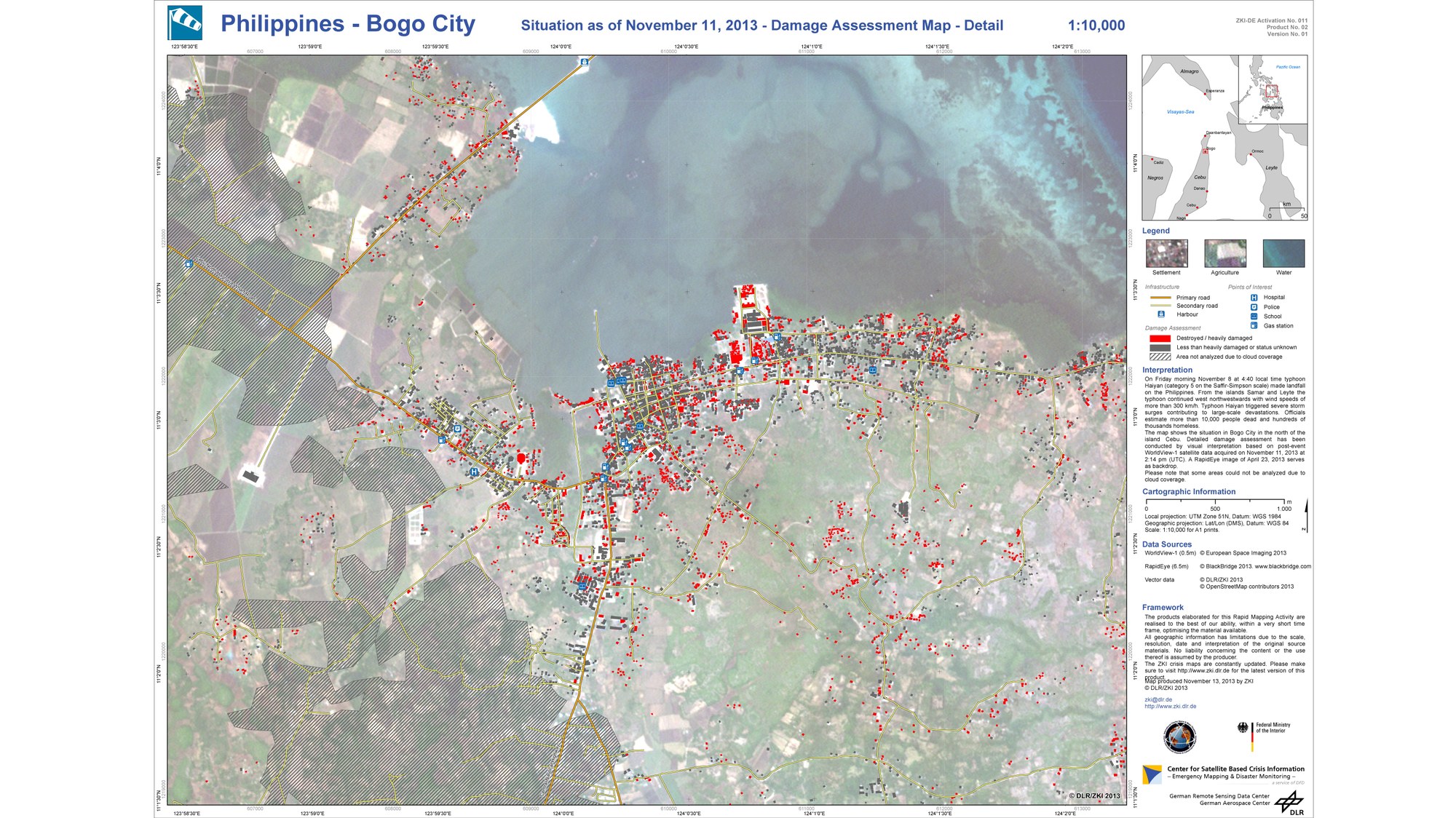
The German Remote Sensing Data Center (Deutsches Fernerkundungsdatenzentrum; DFD) has produced maps of the Philippine island of Cebu based on satellite images for use by emergency response teams working there. On this map, damaged buildings are indicated by red dots.