Topographic map of Ismeniae Fossae
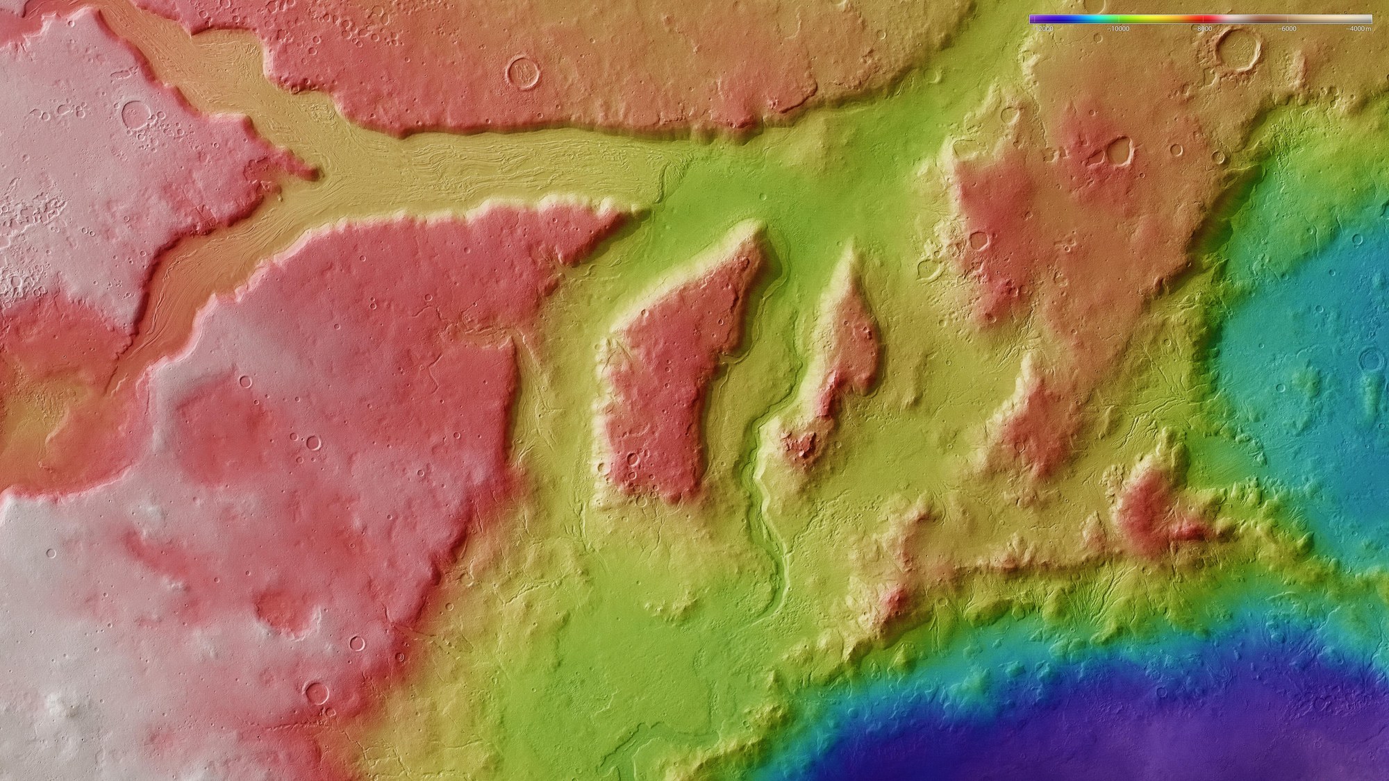

Topographic map of Ismeniae Fossae
Topographic terrain models with an accuracy of 10 to 20 metres can be derived using stereo image data acquired by HRSC, from which the height above or below a reference surface can be determined. In the absence of 'sea level', the elevation data is referenced to an areoid – a modelled equipotential surface on which everything experiences the same gravitational attraction towards the centre of the planet. The slight differences in the plateau's height can be seen in the left half of this image of the Ismeniae Fossae region. The distinctive rectangular cross section of the approximately 2000-metre-deep valley is clearly visible.
Copyright note:
As a joint undertaking by DLR, ESA and FU Berlin, the Mars Express HRSC images are published under a Creative Commons licence since December 2014: ESA/DLR/FU Berlin, CC BY-SA 3.0 IGO. This licence will also apply to all HRSC images released to date.