Topographical map of Hebes Chasma

Topographical map of Hebes Chasma
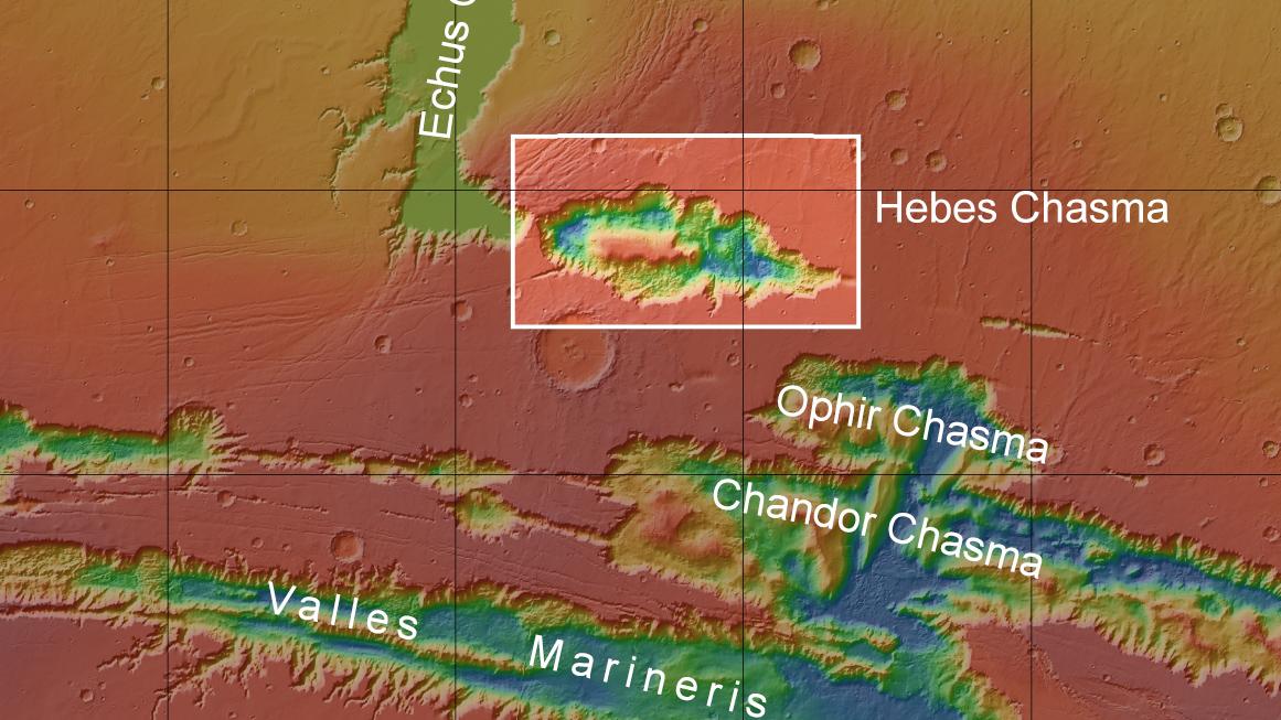
Hebes Chasma is an endorheic (enclosed) basin stretching 315 kilometres in an east-west direction and 125 kilometres from north to south. The High Resolution Stereo Camera operated by DLR on board ESA's Mars Express spacecraft, imaged Hebes Chasma during several overflights (located). The vast extent of this impressive landscape formation is revealed by a mosaic created using eight of the acquired images (the rectangle marked on the topographical map).