Topographical map of Hebes Chasma

Topographical map of Hebes Chasma
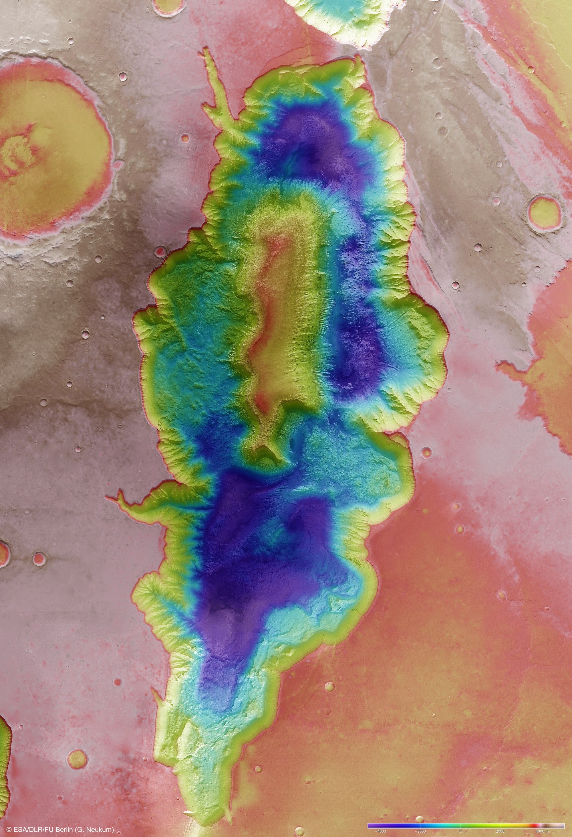
This colour-coded elevation model of Hebes Chasma emphasises just how deep the depression is at roughly eight kilometres. The lowest points of the basin are over 4000 metres below zero elevation on Mars. Rising approximately 4000 metres above zero elevation, the loftiest points in the image belong to the high plains of the Tharsis Plateau.
Copyright note:
As a joint undertaking by DLR, ESA and FU Berlin, the Mars Express HRSC images are published under a Creative Commons licence since December 2014: ESA/DLR/FU Berlin, CC BY-SA 3.0 IGO. This licence will also apply to all HRSC images released to date.