Topographical map of Juventae Chasma

Topographical map of Juventae Chasma
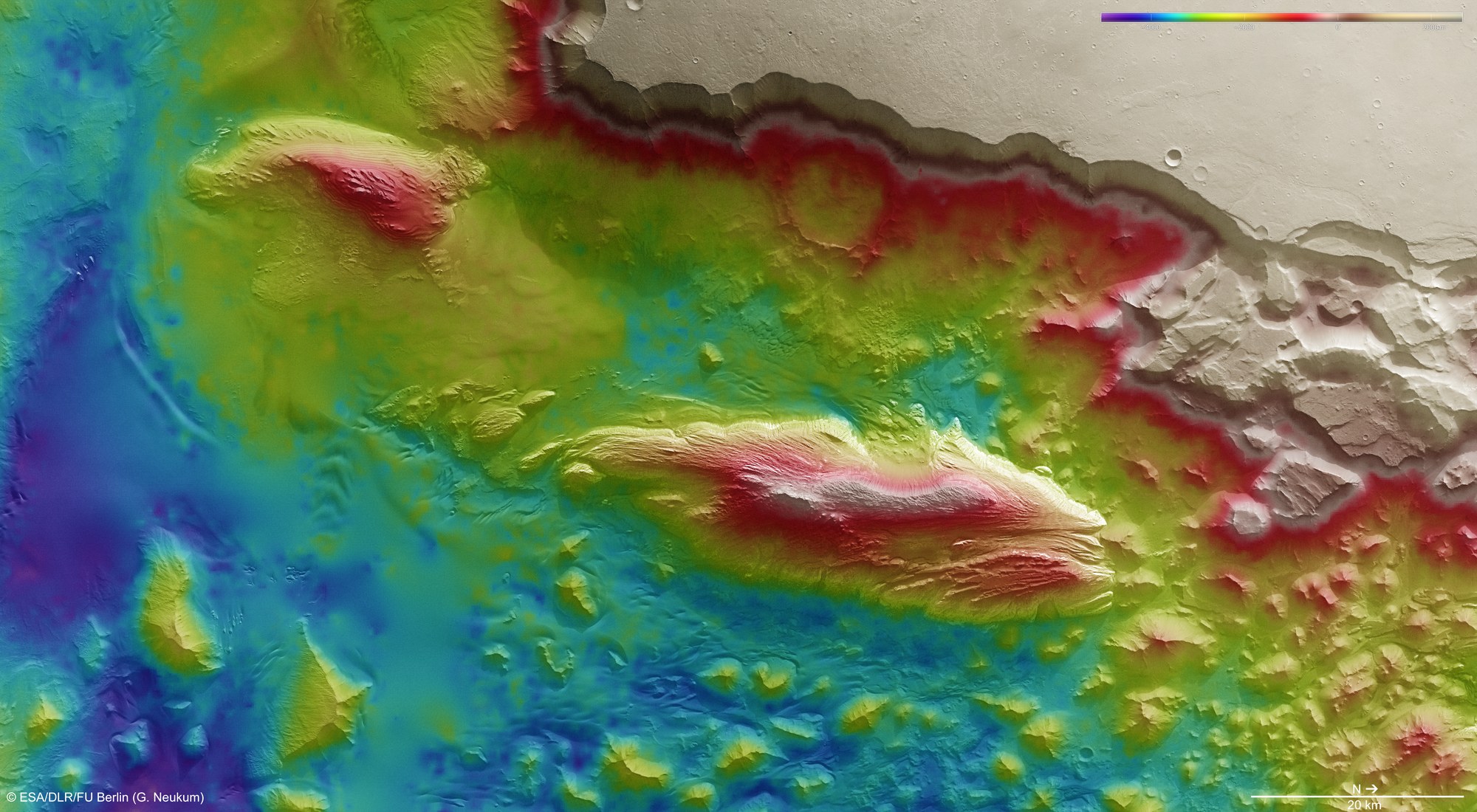
The stereo image data acquired by the HRSC camera system, operated by DLR on board Mars Express, can be used to create digital terrain models. The large-scale formations of the Juventae Chasma basin, which is 5800 metres deep in places, are truly impressive in this colour-coded topographical image. From the high plains of Lunae Planum (upper edge of the image) the plateau abruptly plunges more than 4000 metres to the basin below. Two eye-catching massifs, shaped into their current form by the erosive force of the wind, stand in the centre of the depression; they consist largely of soft sulphate rock. A chaotically disordered landscape, marked by deep erosion, lies adjacent to the north in the outflow channel of Maja Valles.
Copyright note:
As a joint undertaking by DLR, ESA and FU Berlin, the Mars Express HRSC images are published under a Creative Commons licence since December 2014: ESA/DLR/FU Berlin, CC BY-SA 3.0 IGO. This licence will also apply to all HRSC images released to date.