Topographic image of Osuga Valles

Topographic image of Osuga Valles
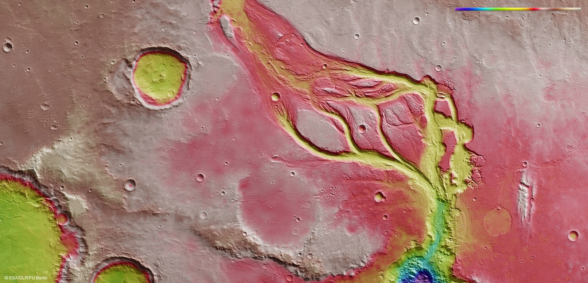
Topographical terrain models with an elevation accuracy of 10 to 20 metres can be computed using stereo image data from the HSRC camera system operated by DLR on board Mars Express. In the absence of ‘sea level’, the elevation data is referenced to an areoid – a modelled equipotential surface on which everything experiences the same gravitational attraction towards the centre of the planet. The grey and red areas are highest; the dark blue and purple coloured areas are the lowest. The image data was acquired on 7 December 2013, during Mars Express orbit 12,624. The resolution is about 17 metres per pixel.
Copyright note:
As a joint undertaking by DLR, ESA and FU Berlin, the Mars Express HRSC images are published under a Creative Commons licence since December 2014: ESA/DLR/FU Berlin, CC BY-SA 3.0 IGO. This licence will also apply to all HRSC images released to date.