Topographical image of the Atlantis basin

Topographical image of the Atlantis basin
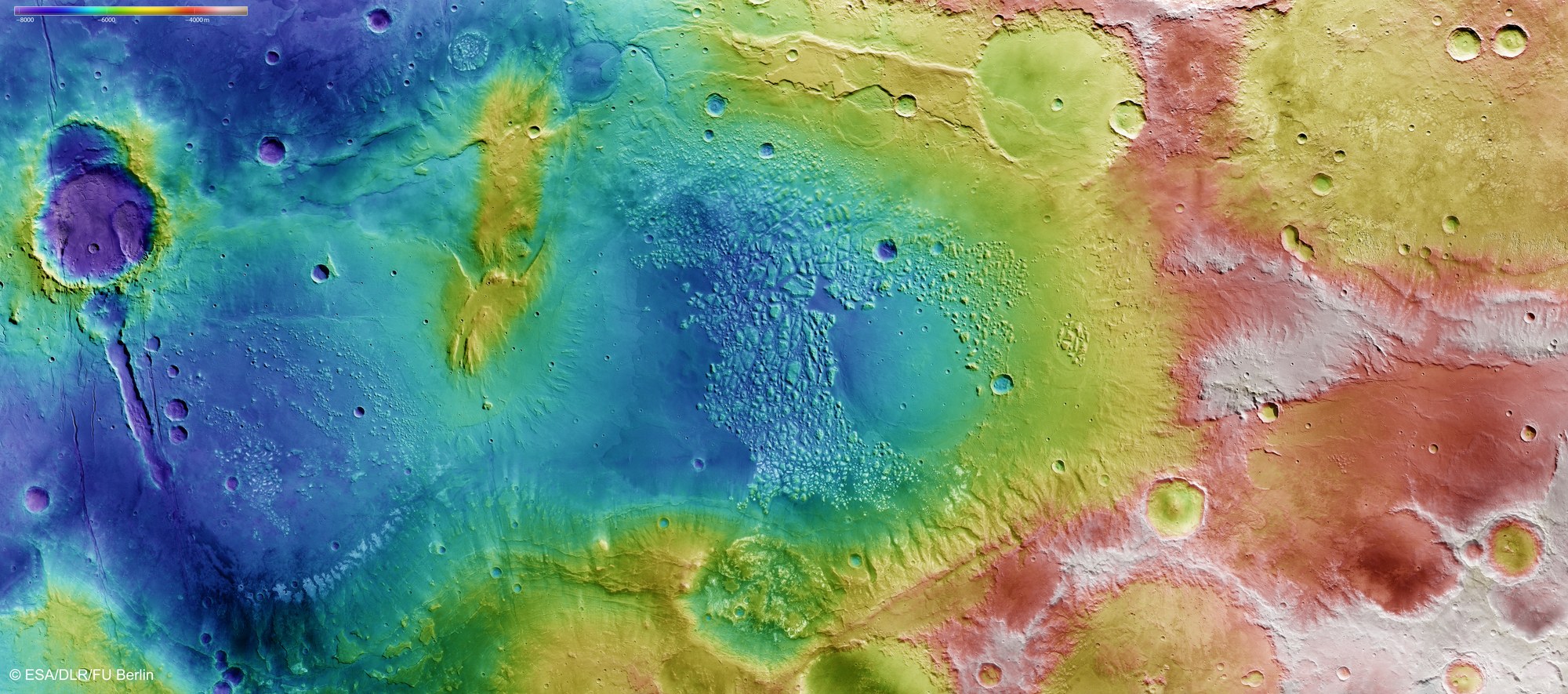
Topographical terrain models can be computed using stereo image data from the HRSC camera system, which is operated by DLR. In the absence of 'sea level', the elevation data is referenced to an areoid – a modelled equipotential surface on which everything experiences the same gravitational attraction towards the centre of the planet. The colour-coded depiction clearly shows the over 4000-metre differences in elevation found in the region. A 'channel', connecting the Atlantis basin in the centre of the image with a smaller basin located further south (in the left of the image), is a striking feature. It appears likely that the depressions were once filled with standing water.
Copyright note:
As a joint undertaking by DLR, ESA and FU Berlin, the Mars Express HRSC images are published under a Creative Commons licence since December 2014: ESA/DLR/FU Berlin, CC BY-SA 3.0 IGO. This licence will also apply to all HRSC images released to date.