Topographic image of the north of Argyre Planitia

Topographic image of the north of Argyre Planitia
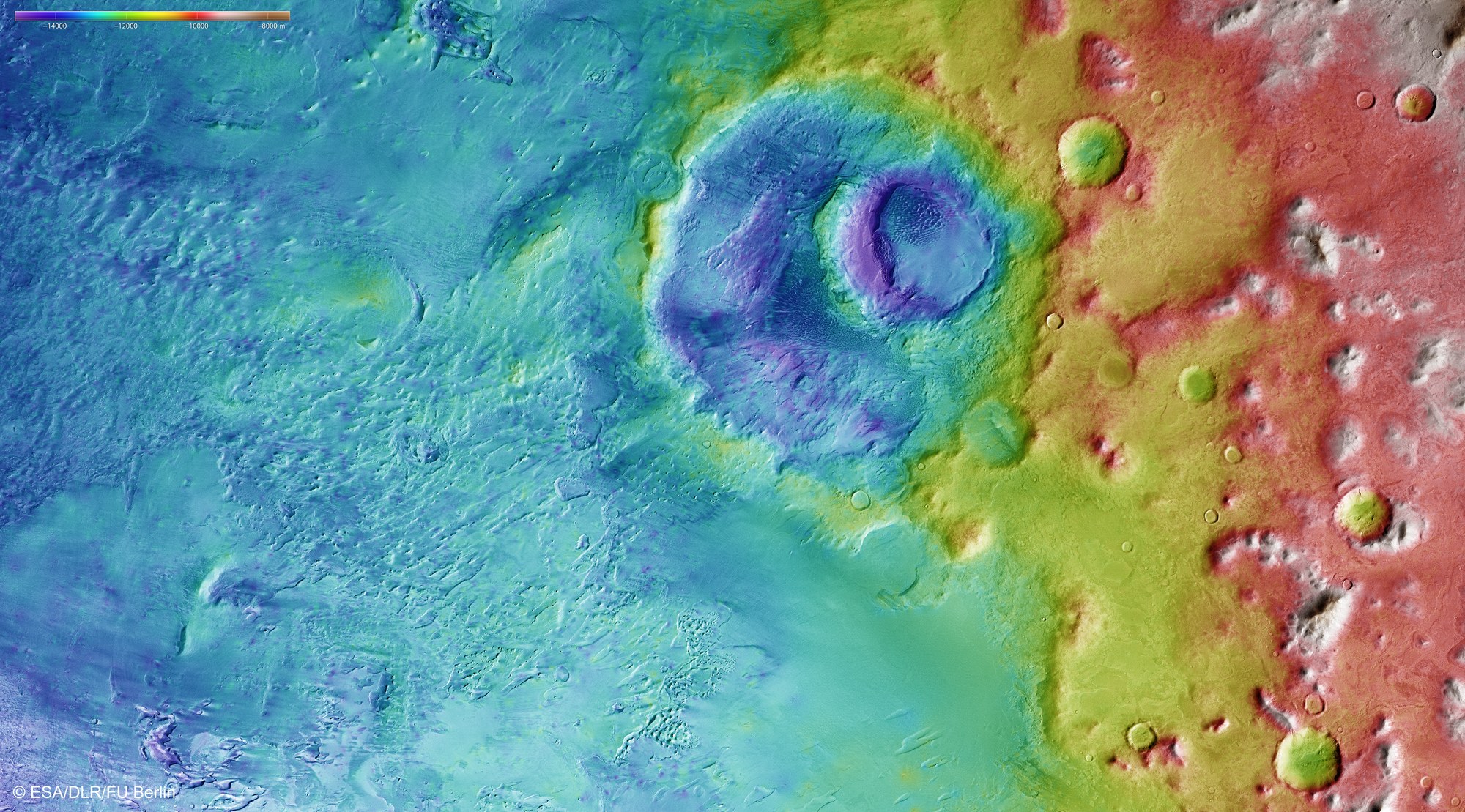
Topographic terrain models are derived from the stereo image data of the HRSC camera system operated by DLR. The altitude differences in the depicted landscape can be represented. North is to the right. In the left half, the plains of Argyre Planitia are visible. In the transition to the edge of the impact basin, the outline of the 150-kilometre Hooke crater is visible along with a second, younger smaller crater in its northern part. The hilly landscape in the north (right) rises more than 4000 metres above the base of Argyre basin.
Copyright note:
As a joint undertaking by DLR, ESA and FU Berlin, the Mars Express HRSC images are published under a Creative Commons licence since December 2014: ESA/DLR/FU Berlin, CC BY-SA 3.0 IGO. This licence will also apply to all HRSC images released to date.