Topographic map of the northwest of Hellas Planitia

Topographic map of the northwest of Hellas Planitia
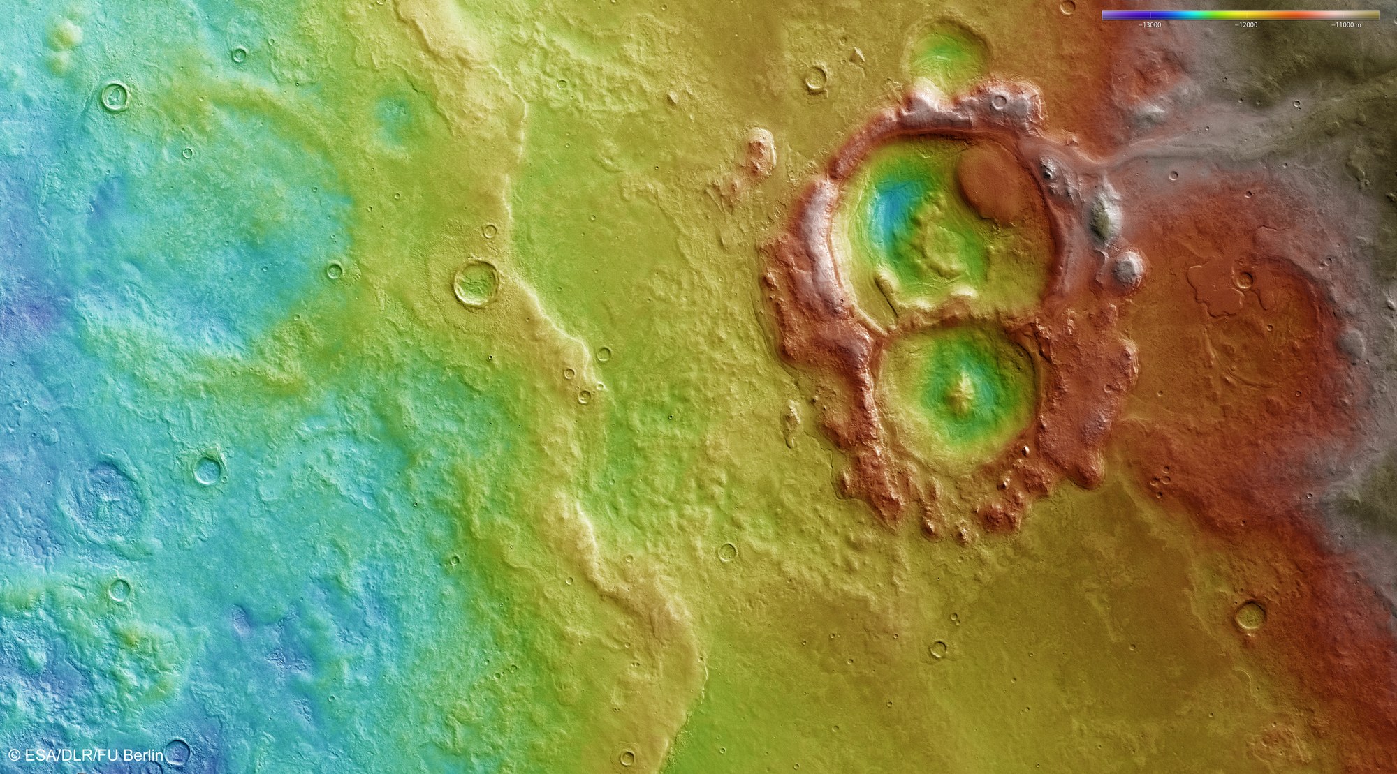
Topographic terrain models are derived from the stereo image data acquired by the HRSC camera system operated by DLR. In the absence of ‘sea level’, the elevation data is referenced to an areoid – a modelled equipotential surface on which everything experiences the same gravitational attraction towards the centre of the planet. In these, even small differences in height can be shown and subtle terrain levels detected such as, for example, a striking flow front of a large solidified lava flow which, coming from the South (left) has come to a standstill roughly in the centre. Unusual structures extend in the direction of two craters from the more than 1000-metre-higher regions in the North, which are probably of glacial origin.
Copyright note:
As a joint undertaking by DLR, ESA and FU Berlin, the Mars Express HRSC images are published under a Creative Commons licence since December 2014: ESA/DLR/FU Berlin, CC BY-SA 3.0 IGO. This licence will also apply to all HRSC images released to date.