Tiu Vallis – colour-coded elevation model

Tiu Vallis – colour-coded elevation model
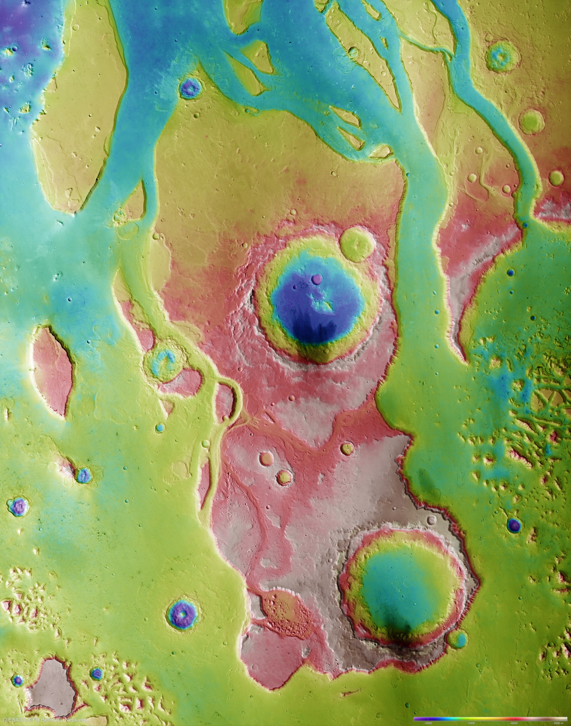
Over the course of 10 separate orbits, the High Resolution Stereo Camera (HRSC) on Mars Express captured image data from the central region of Tiu Vallis, which has been compiled into a mosaic with a resolution of 12.5 metres per pixel. The mosaic extends over 379 kilometres from north to south and 298 kilometres from east to west. It covers a total area of around 113,000 square kilometres, larger than that of the five new German Federal states.
The Tiu Vallis is one of a number of valley systems known in Martian geology as 'outflow channels', which extend from the central Martian highlands for hundreds of kilometres to the plains of the northern lowland. These valley systems are characterised by flow structures and streamlined buttes and craters, around which the highly energetic masses of water that carved out these valleys once flowed.
Digital terrain models have been generated using image data from the HRSC camera system's nadir and stereo channels, from which the topography of the surface can be derived. In this image, colours have been allocated to the different elevations in the landscape. It is clear that the Tiu Vallis and the masses of water flowing within it have dug to a depth of between 1500 and 2000 metres into the northern runouts of the Martian highlands.
Copyright note:
As a joint undertaking by DLR, ESA and FU Berlin, the Mars Express HRSC images are published under a Creative Commons licence since December 2014: ESA/DLR/FU Berlin, CC BY-SA 3.0 IGO. This licence will also apply to all HRSC images released to date.