Topographical image map of Siloe Patera

Topographical image map of Siloe Patera
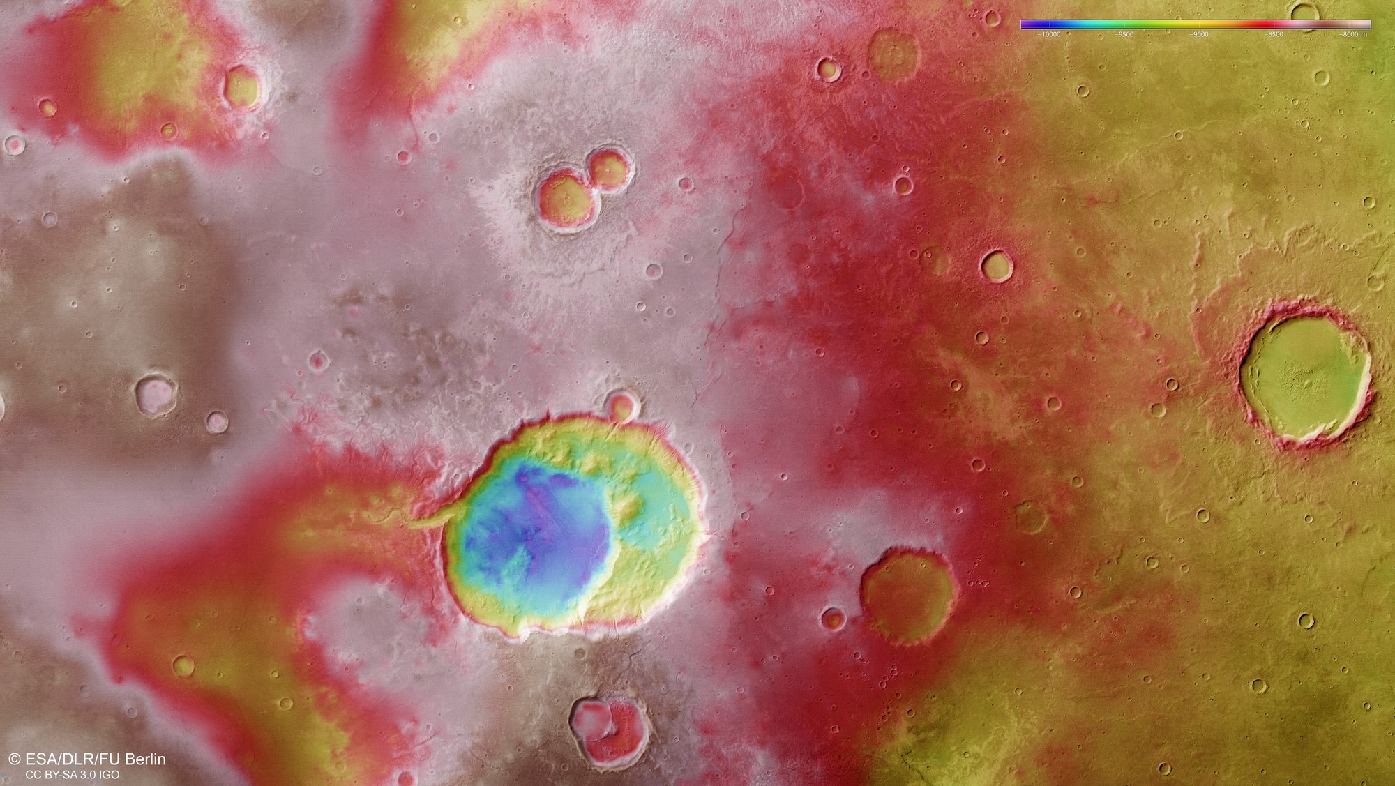
The digital terrain model of Siloe Patera and its environment in Arabia Terra, derived from data acquired by the High Resolution Stereo Camera (HRSC) operated by the German Aerospace Center (Deutsches Zentrum für Luft- und Raumfahrt; DLR) on board ESA’s Mars Express spacecraft, clearly shows the morphology and structure of the double crater. On the basis of the local and regional topography, a group of scientists from the United States came to the conclusion that Siloe Patera is not a conventional impact crater, but the remnant of a huge supervolcano on Mars. The 1750 metre deep hollow, inside which there is a second depression that sinks another 700 metres below the surface, can be clearly seen. However, the theory is being hotly debated.