Occator topography

Occator topography
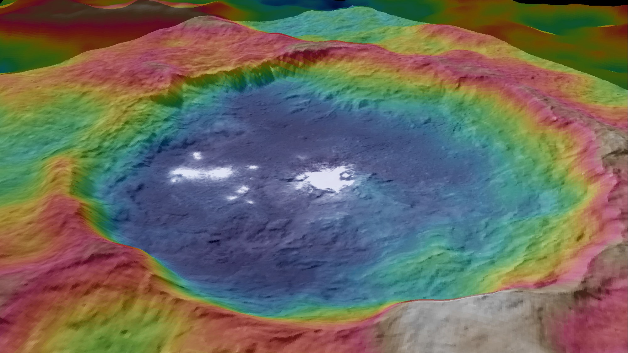
This view, created using images acquired by the German-developed Framing Camera on board NASA's Dawn spacecraft, is a colour-coded topographic map of Occator Crater on Ceres.
Blue is the lowest elevation, and brown is the highest. The crater, which is home to the brightest spots on Ceres, is approximately 90 kilometres across.