Topographic map of the Mangala Valles and Minio Vallis region

Topographic map of the Mangala Valles and Minio Vallis region
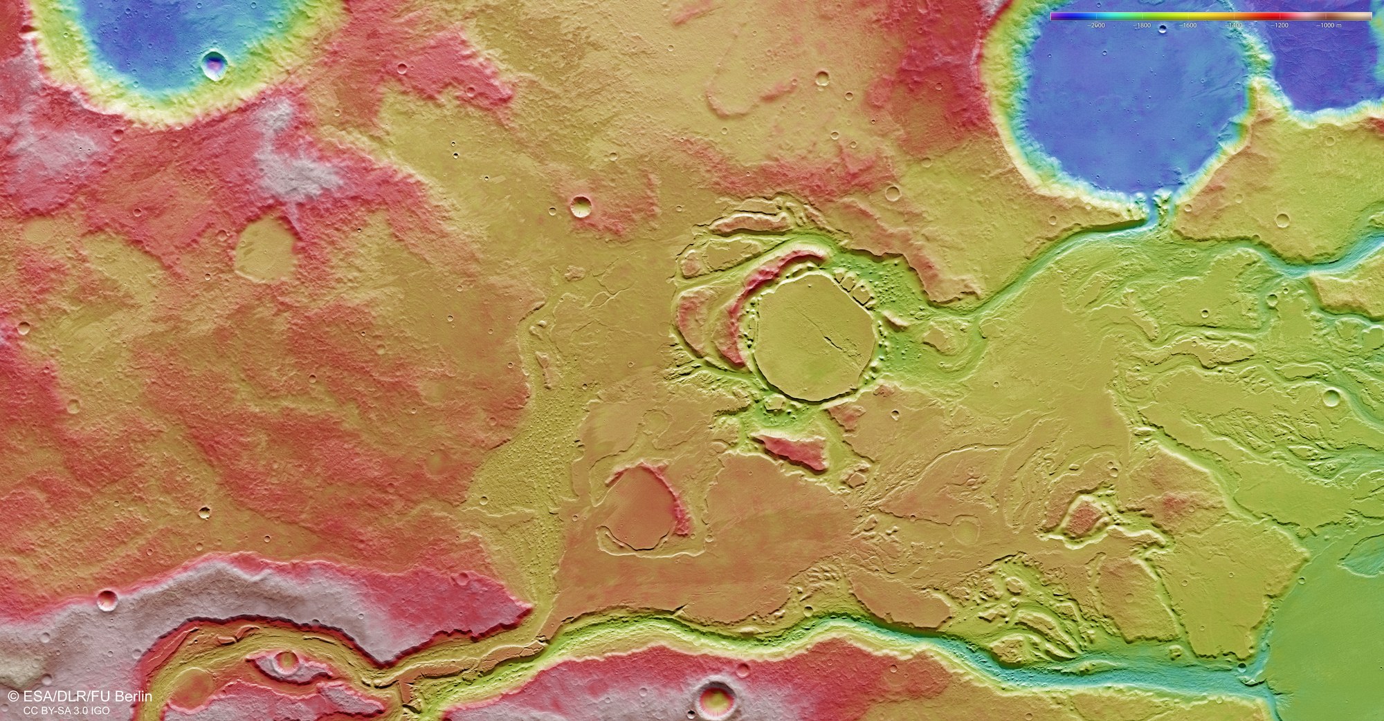
The digital terrain model derived from the stereo image data acquired by the HRSC on ESA’s Mars Express spacecraft clearly shows, to a few tens of metres, the elevation differences in the area. The deepest, blue-tinted regions are located in a crater 28 kilometres in diameter in the upper right quadrant of the image. Based on the different colours in the valley that opens into the crater, the slope of the river can be reconstructed upwards into the valley; it flushed the sediments from the region, located about 500 metres higher up than the crater, where they formed a completely flat surface. The height difference among the highest regions in the image, shown in red and pink tones, is another 400 to 500 metres; these are presumably made of solidified, low-viscosity basaltic lava, like the layers in the centre of the image.