Topographic view of a high mountain peak on Ceres

Topographic view of a high mountain peak on Ceres
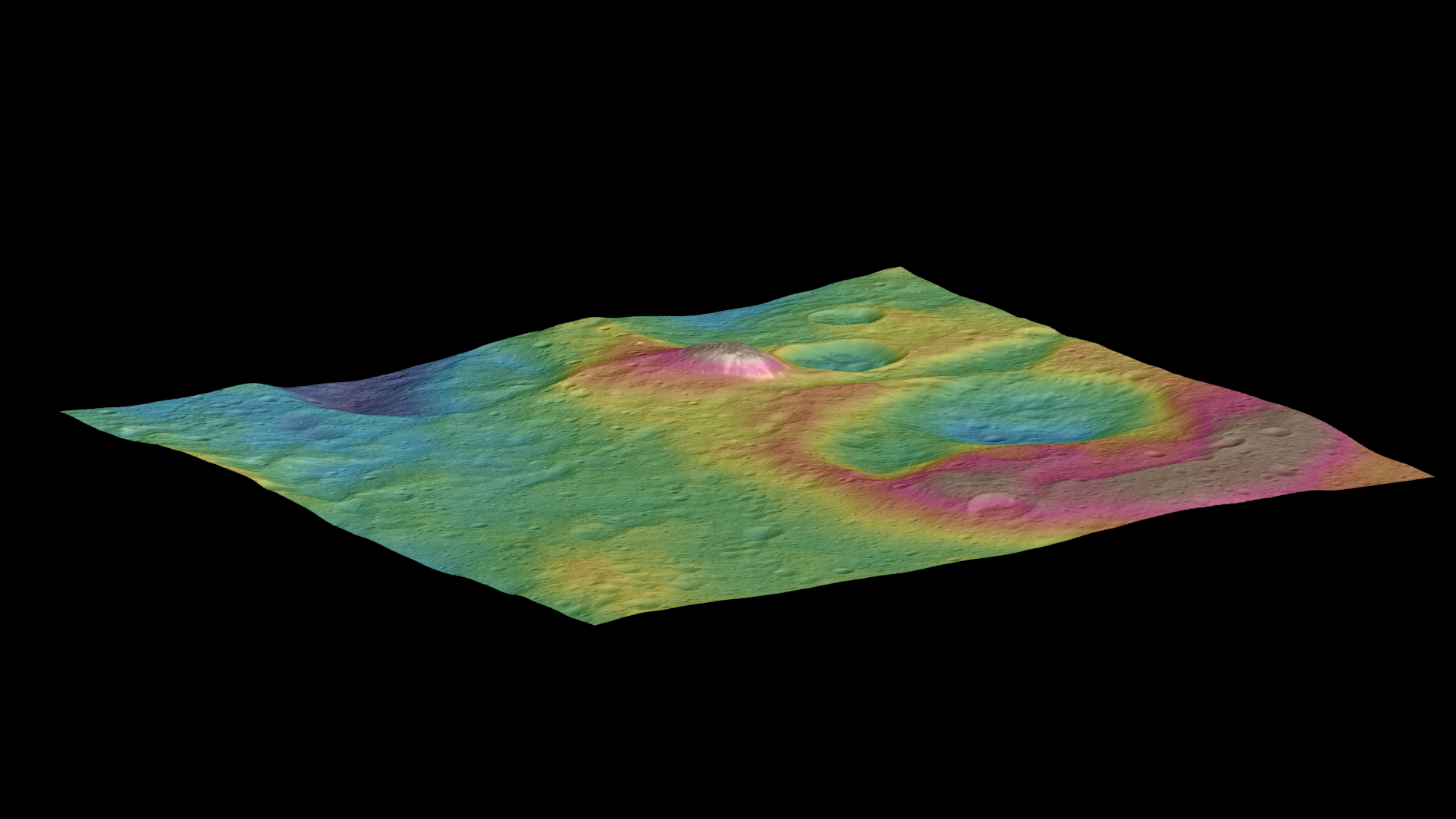
This view, generated using images acquired by the German-developed Framing Camera on board NASA’s Dawn spacecraft, is a colour-coded topographic map showing a tall, cone-shaped mountain on Ceres.
Elevations span a range of about eight kilometres from the lowest places in this region to the highest terrains, with the mountain rising some six kilometres above its immediate surroundings. Blue represents the lowest elevation, and brown is the highest. The white streaks seen running down the side of the mountain are especially bright parts of the surface.
The image was generated using two components – images of the surface acquired during Dawn’s High Altitude Mapping Orbit (HAMO) phase, where it viewed the surface at a resolution of about 140 metres per pixel, and an elevation model generated using images acquired at varying Sun and viewing angles during Dawn’s lower-resolution survey phase. The image of the region is colour-coded according to elevation, and then draped over the shape model to give this view.