Colour-coded image of the topography of Aeolis Mensae

Colour-coded image of the topography of Aeolis Mensae
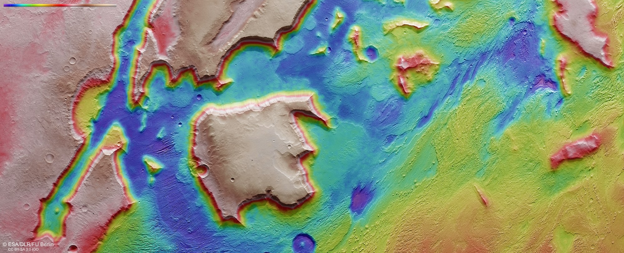
The nadir channel, which is directed vertically down onto the surface of Mars, and the stereo channels of the High Resolution Stereo Camera (HRSC) on board Mars Express acquire images that enable the production of digital terrain models of the Martian surface at an accuracy of up to 10 metres per pixel. This colour-coded representation clearly shows the absolute elevations above a reference level, the areoid (taken from Ares, the Greek name for Mars). The colour scale at the top left of the image indicates the actual elevation. This view produces a bizarre pattern in the region of Aeolis Mensae, where isolated mesas tower like icebergs 2500 metres above the surrounding terrain. The colour gradations on the sides of the mesa show just how steep the flanks are.