False-colour representation of the topography on the western edge of Aurorae Chaos

False-colour representation of the topography on the western edge of Aurorae Chaos
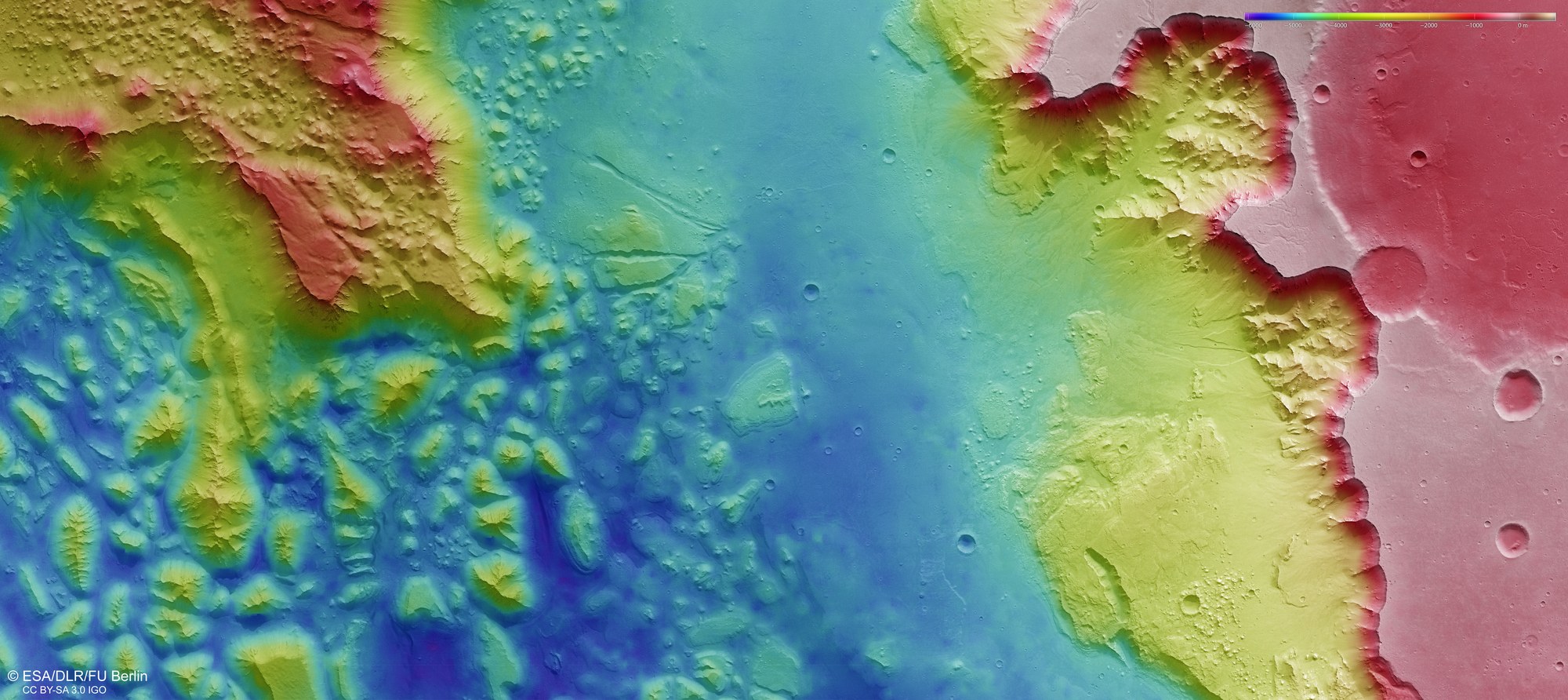
Digital terrain models of the Martian surface can be generated with an accuracy of 10 to 50 metres per pixel from the nadir and stereo channels of the High Resolution Stereo Camera (HRSC) on board Mars Express. In this colour-coded illustration, the absolute elevations above a reference level, the aeroid (derived from Ares, the Greek word for Mars), are well depicted. These elevation values can be read based on the colour legend at the top right of the image. The differences in elevation are immense! The areas of the surrounding Martian highlands lay 3500 to 5000 metres above the western runout of Aurorae Chaos shown in yellow green or light and dark blue. The individual peaks of the chaotic regions (left half of the image) are between 1500 and 2000 metres high. In this illustration, north is to the right.