The last hurdle for Mark Watney - the edge of Schiaparelli crater


The last hurdle for Mark Watney - the edge of Schiaparelli crater
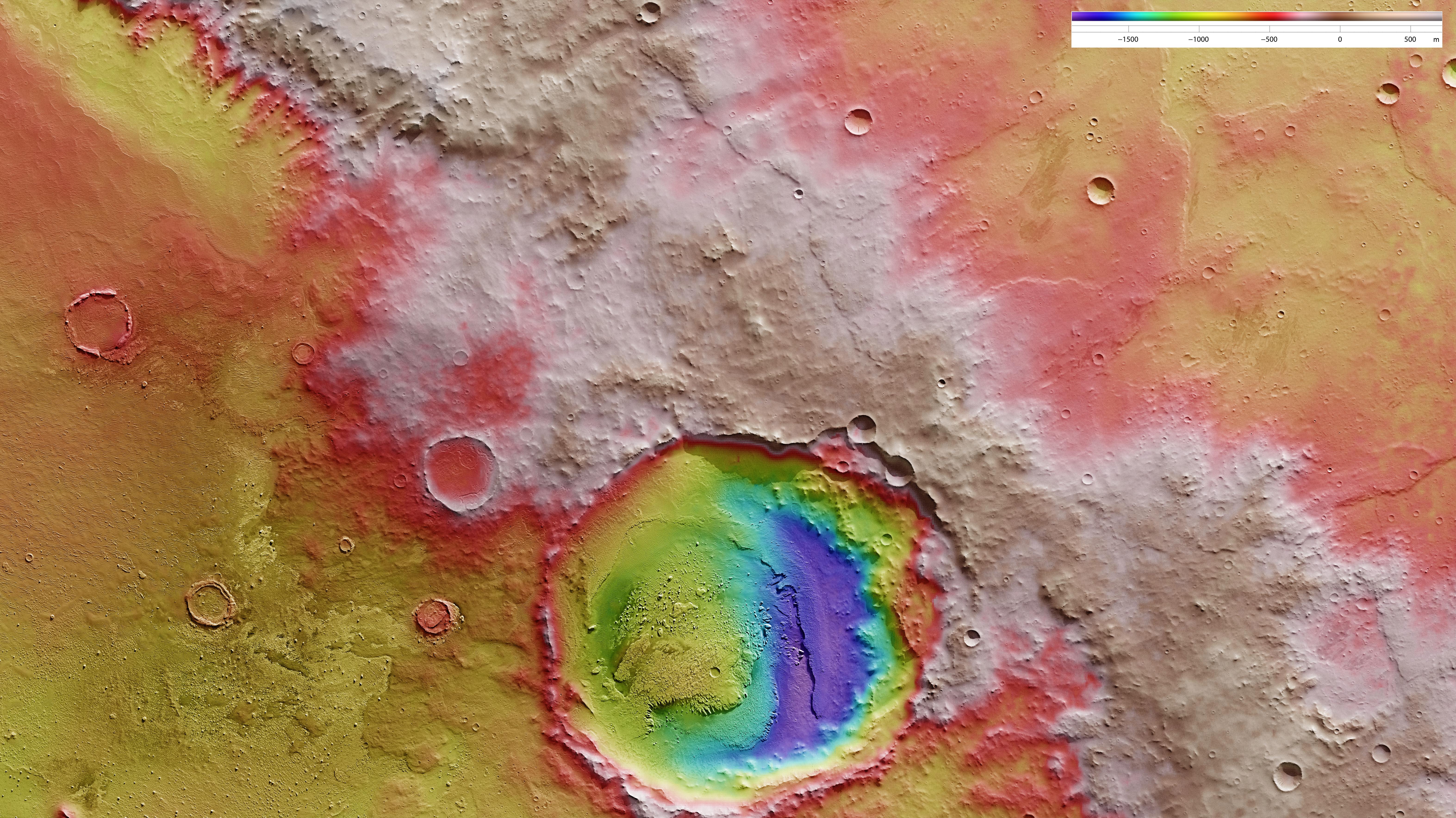
Schiaparelli crater has a 460 kilometre diameter and is located in the eastern Terra Meridiani region of the equator of Mars. This topographical map of the northwest rim of Schiaparelli reveals an approximately 25-kilometre crater in the raised crater rim; North is to the right in the image. The terrain is steep in places and therefore, dangerous for ‘The Martian’ Mark Watney and his fragile vehicle so, based on topographical data, he had to find the least steep route possible. He found this west (above) of the crater in the form of a sort of natural ramp, which formed as a result of a landslide in the crater rim, possibly during the impact that produced the small crater. On this ramp, he drove nearly 1000 metres down Schiaparelli - and was able to tackle the last 100 kilometers to the Ares 4 rocket. The crater was named after the Italian astronomer Giovanni Schiaparelli (1835-1910), who created the first good map of Mars between 1877 and 1879.