Colour-coded image of the topography of the western part of Arda Valles

Colour-coded image of the topography of the western part of Arda Valles
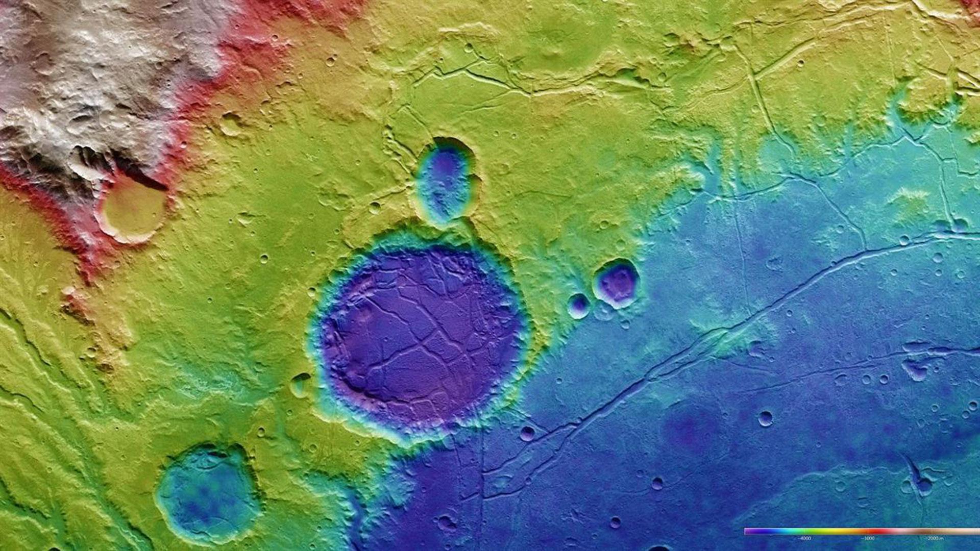
Digital terrain models of the Martian surface with a resolution down to 10 metres per pixel can be derived from data acquired by the nadir channel, which is directed vertically onto the Martian surface, and the stereo channels of the High Resolution Stereo Camera (HRSC) on Mars Express. In this colour-coded image, the absolute elevations above a reference level, the aeroid (derived from Ares, the Greek name for Mars), are depicted. These elevation values can be read based on the colour key at the lower right of the image.
The maximum differences in elevation values exceed 3500 metres. The colour distribution gives a clear picture of the topography in this area. A very old, heavily eroded impact basin, filled to the brim with sediments is seen in the northeast – lower right in the image. Arda Valles is located in the former crater rim and apparently drained into this basin. In the basin edge, there is a younger crater, also filled with sediment that has been broken up to produce ‘chaotic terrain’. At the top centre of the image, there is a mountain range from which material was transported to lower-lying areas.