Topographical context map of the western rim of the Hellas impact basin

Topographical context map of the western rim of the Hellas impact basin
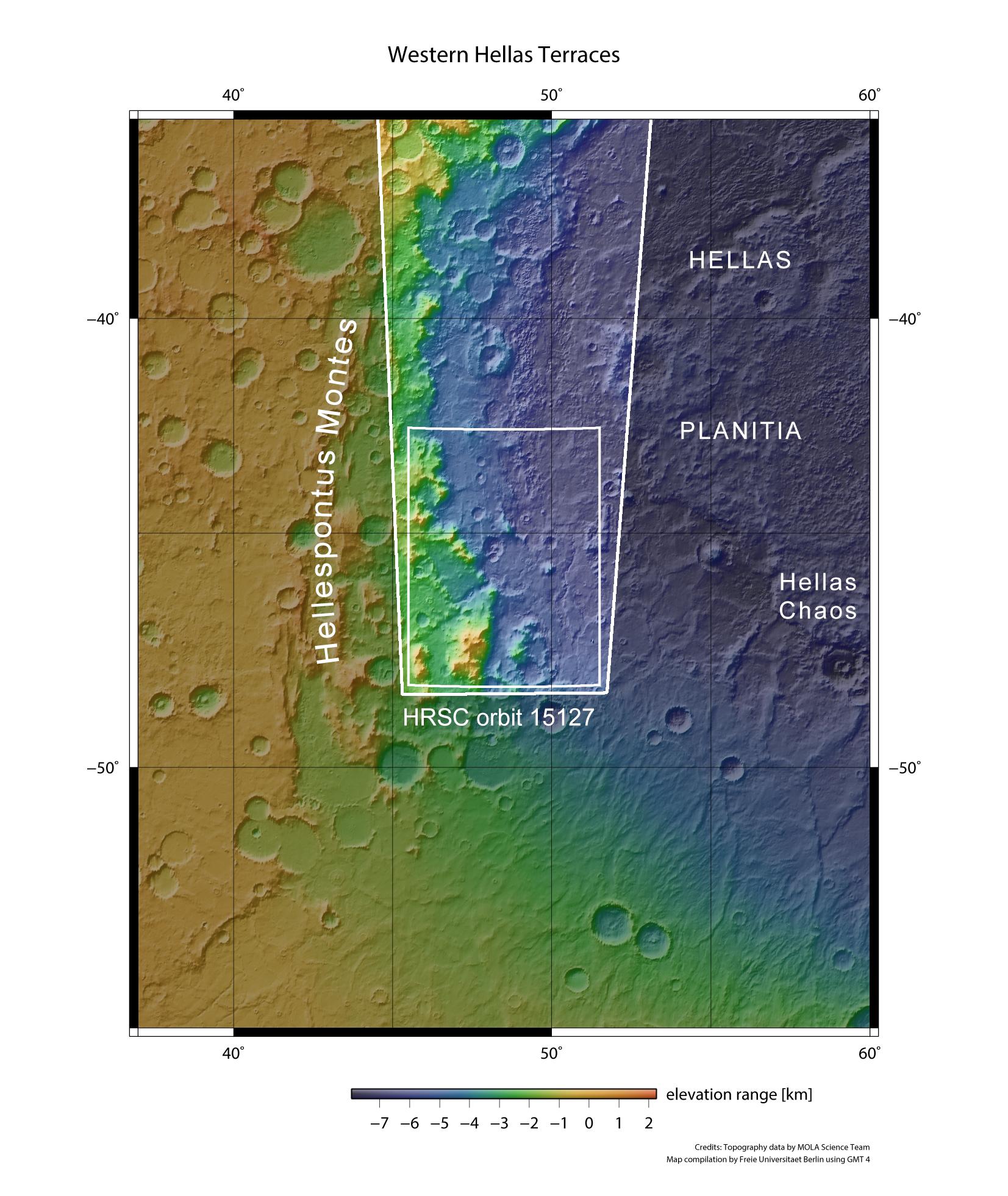
The Hellas impact basin is located in the highlands of the Martian southern hemisphere. The region described in the article is located in the smaller of the two rectangles marked in white. The HRSC (High Resolution Stereo Camera) images were acquired on 6 December 2015 during Mars Express orbit 15,127. The image is centred at 48 degrees East and 45 degrees South. With a diameter of 2200 kilometres, Hellas basin is the largest impact structure on Mars. The altitude difference from the highest mountain peaks in the raised rim of the crater to the lowland plain in the centre of the crater is nine kilometres.