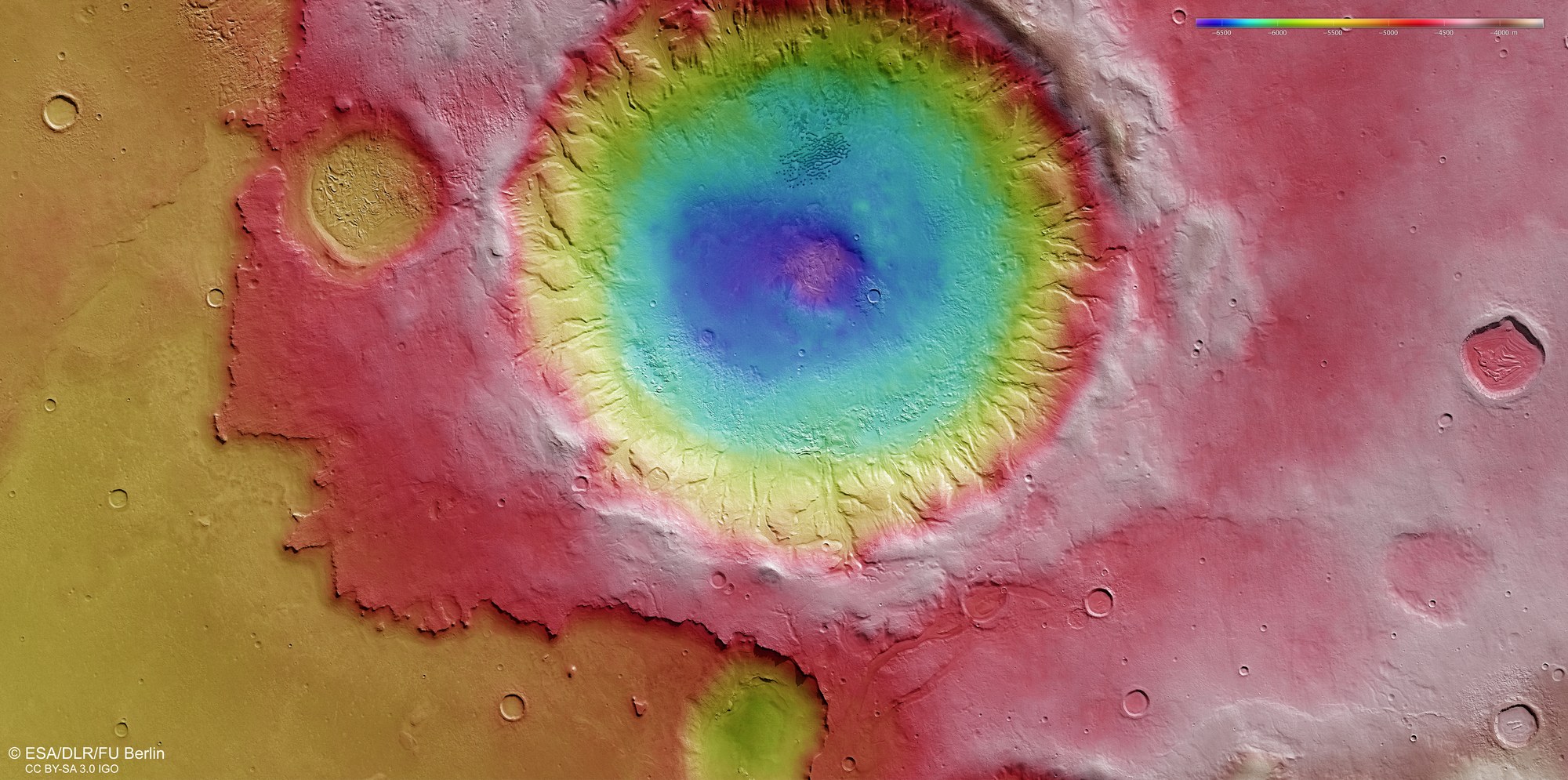
False colour image of the topography of a crater in Noachis Terra

False colour image of the topography of a crater in Noachis Terra
Digital terrain models of the Martian surface can be created with an accuracy of up to 10 metres per pixel using the nadir channel directed vertically onto the Martian surface and the stereo channels of the High Resolution Stereo Camera (HRSC) on Mars Express. In this colour-coded image, the absolute elevations above a reference level, the Aeroid (derived from Ares, the Greek word for Mars), are depicted.
Using the legend for the elevation scale – at the top right in the image – it is possible to see that, at present, the crater has a depth of around four kilometres; originally, the crater was even deeper, but sediments have been deposited over the course of millions of years on its soil – some transported downwards through the gullies and valleys in the crater walls and others brought in by the wind.