False-colour map of the topography of Colles Nili
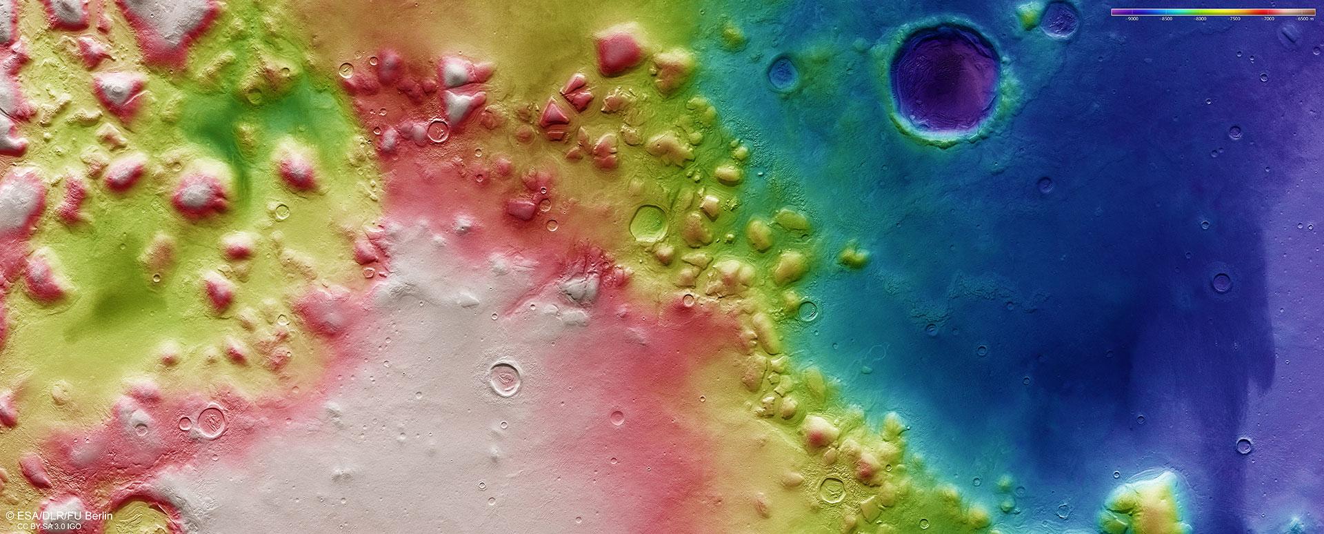

False-colour map of the topography of Colles Nili
Digital terrain models of the Martian surface can be derived from data acquired by the nadir channel of the HRSC, which is directed vertically onto the Martian surface, and the stereo channels; accuracies as good as 10 metres per pixel can be achieved. In this colour-coded map, the absolute elevations above or below a reference level, the Areoid (derived from Ares, the Greek name for Mars), can be clearly seen. The key to the elevation values is the colour scale at the top right of the image. The differences in elevation depicted here clearly show the start of the transition from the northern lowlands (right in the image) to an area with complex topography and numerous 1000 to 2000 metre-high ‘escarpment outliers’. These were once part of the Martian highland located further to the south (left in the image) and have not been completely worn away by erosion.