Topographical image map of the Cerberus Fossae region

Topographical image map of the Cerberus Fossae region
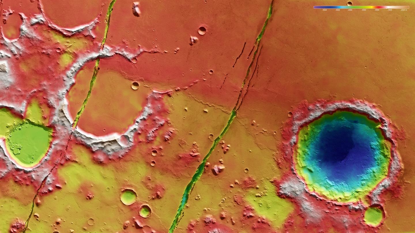
The strips of photographs taken, from various angles, by the HRSC camera system aboard Mars Express, provided the basis for computing digital terrain models for the surface of Mars, including elevation models for each area of the photographs. The colour-coded topographic view (5) is based on a digital terrain model (DTM) of the region, from which the topography of the landscape can be derived. The reference body for the HRSC-DTM is a Mars equipotential surface (Areoid). Differences in elevation are easily distinguished, thanks to the digital terrain model’s colour coding: the lowest elevation area, in a large crater which is approximately 30 kilometres wide, is located 5500 metres below the Areoid, and the regions shown in red, at -3000 metres, are located at least 2.5 kilometres higher. The Cerberus Fossae are up to 500 m deep.