MASCOT's approach to Ryugu and its path across the surface

MASCOT's approach to Ryugu and its path across the surface
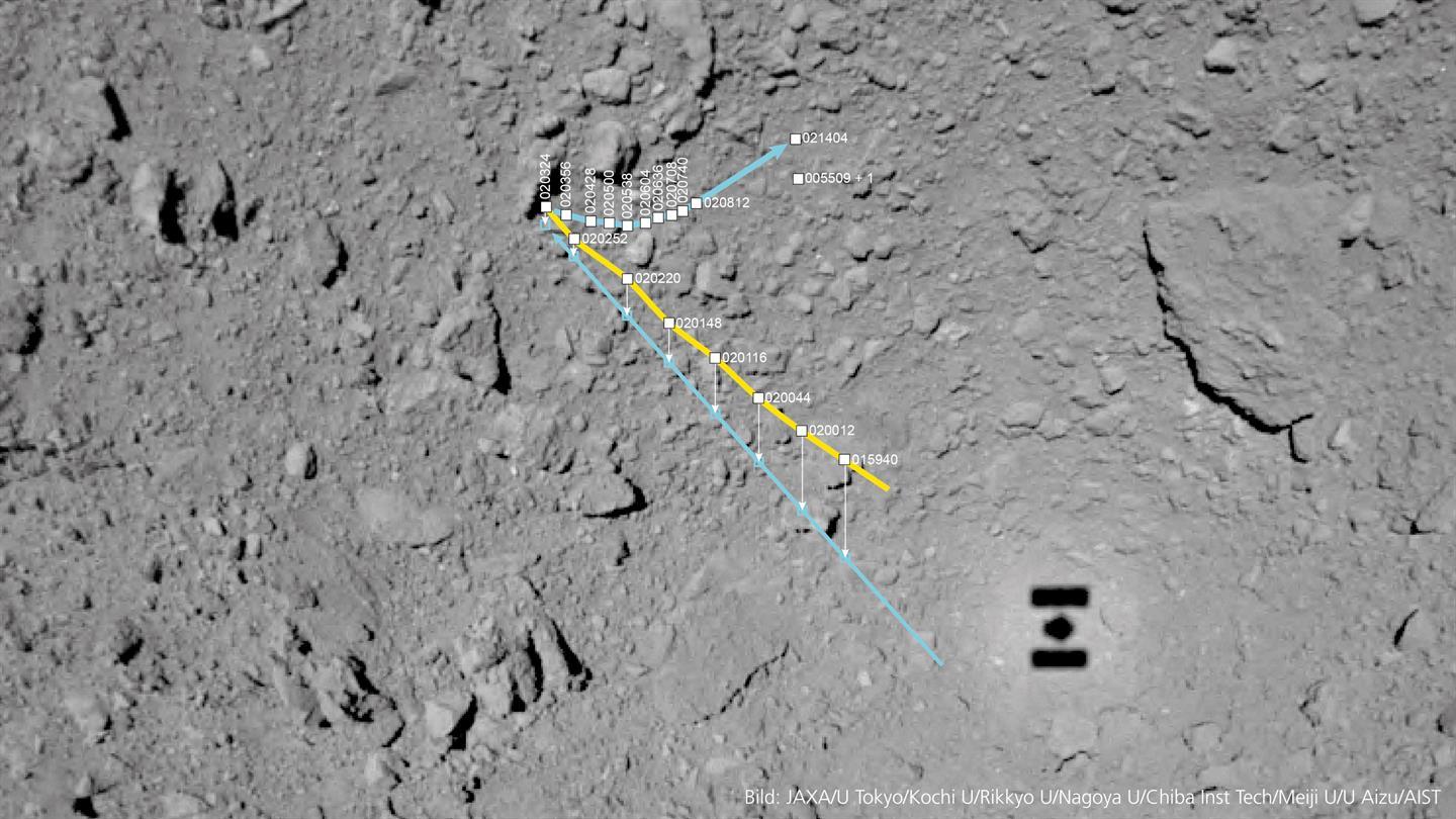
After MASCOT had separated from its mothercraft, Hayabusa2's ONC (Optical Navigation Camera) recording system, with its three cameras, began following MASCOT’s descent to the asteroid Ryugu from a height of 51 metres. The image section is oriented to the north, and the area shown is located at approximately 300 degrees east and 30 degrees south. Hayabusa2’s shadow can be seen on the lower right. At the time of the separation, it was about noon on Ryugu and the Sun was behind Hayabusa2 – the shadow is about six by 4.5 metres. The points indicate the times at which Hayabusa2 acquired images of MASCOT. The times are in UTC (Coordinated Universal Time, CEST minus two hours), the first image was acquired at 01:59 and 40 seconds UTC (03:59:40 CEST). The yellow line indicates the locations at which MASCOT was still descending towards Ryugu and where it could be identified in the ONC photos. The blue line below the yellow line is the projection of these positions onto the asteroid surface – so this shows MASCOT's flight route was rather straight, and the lander touched down on a large edgy block at around 02:23 and 24 seconds UTC. From there, the asteroid lander hopped along the curved horizontal line towards the east-northeast and was then repeatedly imaged by the ONC. At around 02:14 and 04 minutes UTC MASCOT came to rest at its first location on the asteroid. Meanwhile, Hayabusa2 ascended to a higher observation position over Ryugu, making it more difficult to identify MASCOT in the images due to the lower image resolution. On the second asteroid day, MASCOT's mobility mechanism was activated. Another image will show the lander on 4 October at 00:55 and nine seconds UTC.