Topographical overview map of Nili Fossae on Mars


Topographical overview map of Nili Fossae on Mars
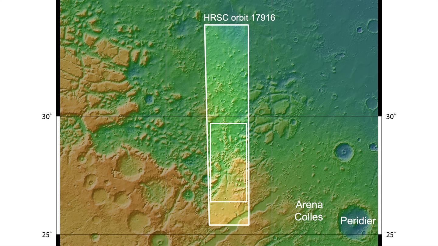
Nili Fossae is a 30-kilometre-wide tectonic system of grabens on the boundary between the Martian highlands and the northern lowlands. The transition between these two major topographical Martian landscapes, known as the dichotomy boundary, is particularly typical here: the smooth highland plains form a terrain edge several thousand metres high, breaking away to the north. The foothills are home to some standalone mesas that have survived erosion, while large expanses of hilly terrain stretch out further to the north. DLR’s High Resolution Stereo Camera (HRSC) on board the ESA Mars Express spacecraft surveyed the area on 26 February 2018 from an altitude of around 400 kilometres, during orbit 17,916.