Topographical image map of Chalcoporos Rupes

Topographical image map of Chalcoporos Rupes
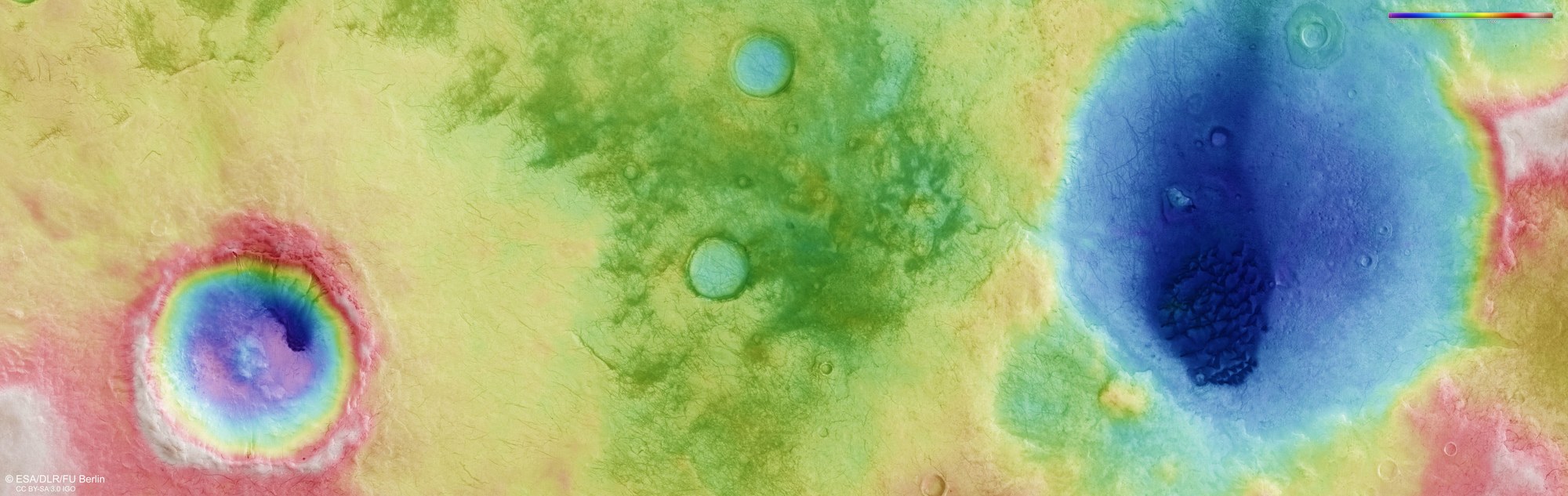
The image strips captured from different angles by the High Resolution Stereo Camera (HRSC) on board Mars Express were used to generate digital terrain models of the Martian surface. They contain height information for each recorded pixel. The reference level to which the altitude readings refer is an imaginary surface that represents the same gravitational pull as that at sea level on Earth. Known as an equipotential surface, this is shaped like a biaxial ellipsoid and is known as an Areoid, a name derived from Ares, the Greek name for Mars. In this image, north is to the right. The colour coding of the digital terrain model (top right) indicates the elevation differences effectively: the topographical profile of the region covers roughly 1200 metres of elevation and shows that the Martian highlands in this area form an extensive plateau without any major differences in height, apart from the depressions of two large craters, whose entire profile has already been significantly levelled by erosion. On the upper (western) rim of the larger crater is another smaller crater whose circular ejecta blanket stands out strikingly against the topographical image map. Known as a rampart crater, this is typical of certain regions on Mars where underground ice is (or once was) present. An asteroid impact creates this distinctive ejecta blanket, which is formed by rock debris mixed with water. .