Mars from the North Pole to the Hellas Basin.

Mars from the North Pole to the Hellas Basin.
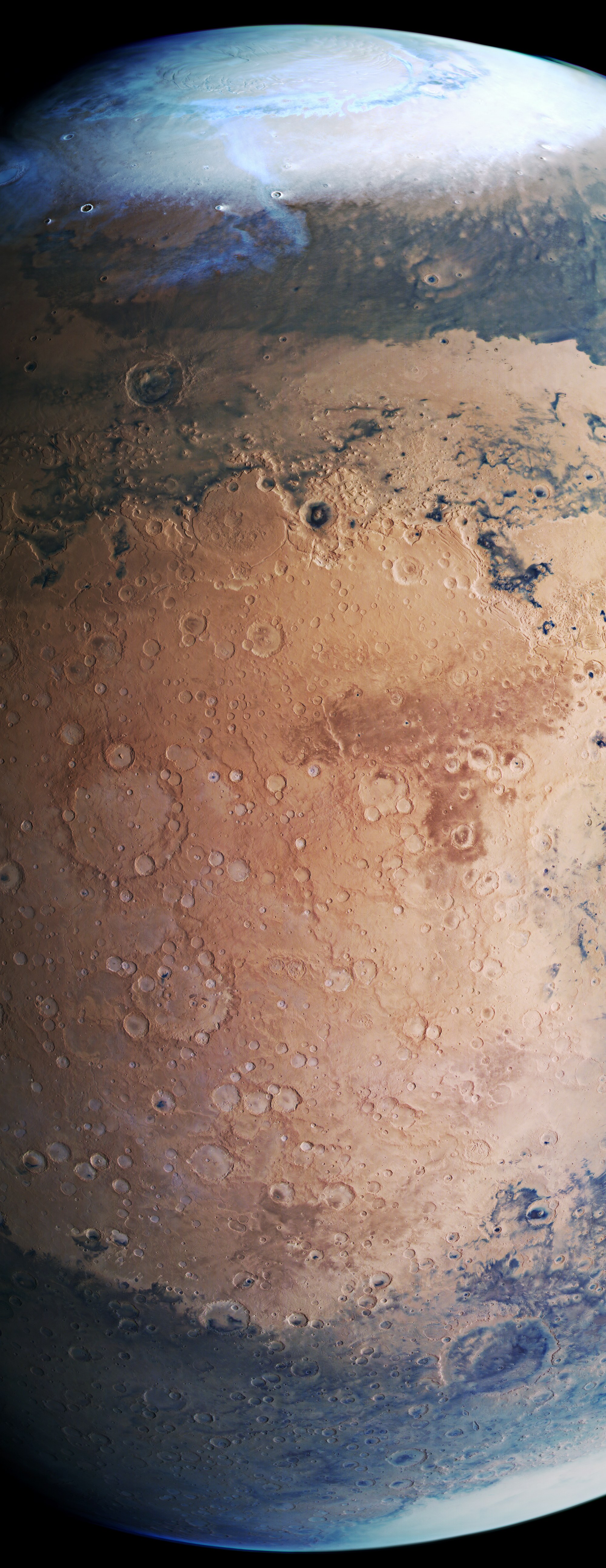
This extraordinary image shows the northern hemisphere of Mars in spring, with its polar cap – composed of water ice but with a covering of carbon dioxide ice – extending down to approximately 70 degrees north . Beneath this are the vast plains of Vastitas Borealis (Latin – northern wastelands), with a veil of cloud stretching towards the south, over areas covered with dark sand. Next, at 50 degrees north, is Lyot Crater with its striking double rings. In the centre of the picture, an obvious escarpment marks the transition between the lower-lying and geologically younger plains of the northern lowlands and the southern Martian highlands. The far higher number of craters seen here shows that the southern highlands are much older than the northern lowlands. The 40-degree east line of longitude runs through the centre of the image, from north to south. To the left of the centre of the image is the region of Arabia Terra, with the striking landmark of the 415-kilometre Cassini Crater, named after the eminent Italian-French astronomer Giovanni Domenico (Jean-Dominique) Cassini (1625–1712). South of the Equator (in the bottom quarter of the picture) are the Terra Sabaea highlands, again covered by extensive dark layers of sand and dune fields. A large double-ringed crater, Huygens Crater, can also be seen here. In the southeast (bottom right) is the largest impact crater on Mars, Hellas Planitia, which is 2000 kilometres across. Here, it is covered by clouds. The image data were acquired in June 2019 by the High Resolution Stereo Camera (HRSC) on board ESA’s Mars Express spacecraft.