MASCOT's descent and path across the surface of Ryugu

MASCOT's descent and path across the surface of Ryugu
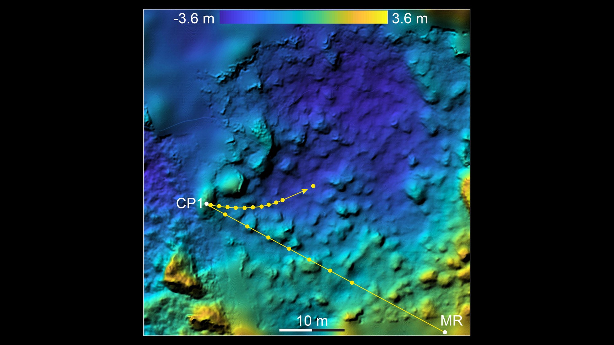
After MASCOT was ejected from Hayabusa2’s loading bay, the lander’s Optical Navigation Camera (ONC) system tracked the lander’s descent from an altitude of 41 metres. These images made it possible to project the trajectory of the descent path from the separation (MR = MASCOT Release point) to the first contact (CP1 = Contact Point 1) onto the surface as well as to reconstruct the further course of the MASCOT mission on Ryugu. This image shows a digital terrain model of the landing site, in which the height differences from minus 3.6 metres to plus 3.6 metres – related to a reference level – are colour-coded. The image section is oriented to the north; the area is approximately 300 degrees east and 30 degrees south on Ryugu.