Haiti earthquake – change analysis


Haiti earthquake – change analysis
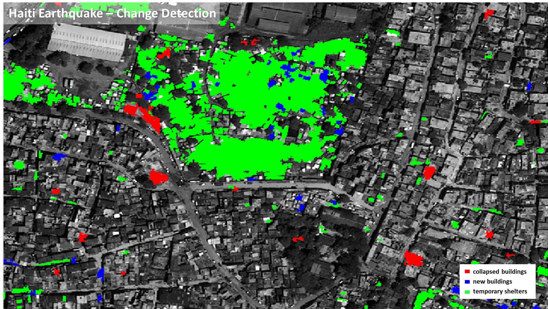
On 12 January 2010, a severe earthquake struck Haiti. The after image, acquired on 18 August 2010 shows which buildings are still destroyed, where new buildings have been erected and the exact distribution of makeshift shelters. The changes in the buildings were automatically recorded. The DLR Earth Observation Center used processing methods based on machine learning and data from the remote sensing satellite GeoEye-1, which has a resolution of 0.5 metres.