Meteosat-11 satellite data compared with a model for the optical thickness of ice clouds


Meteosat-11 satellite data compared with a model for the optical thickness of ice clouds
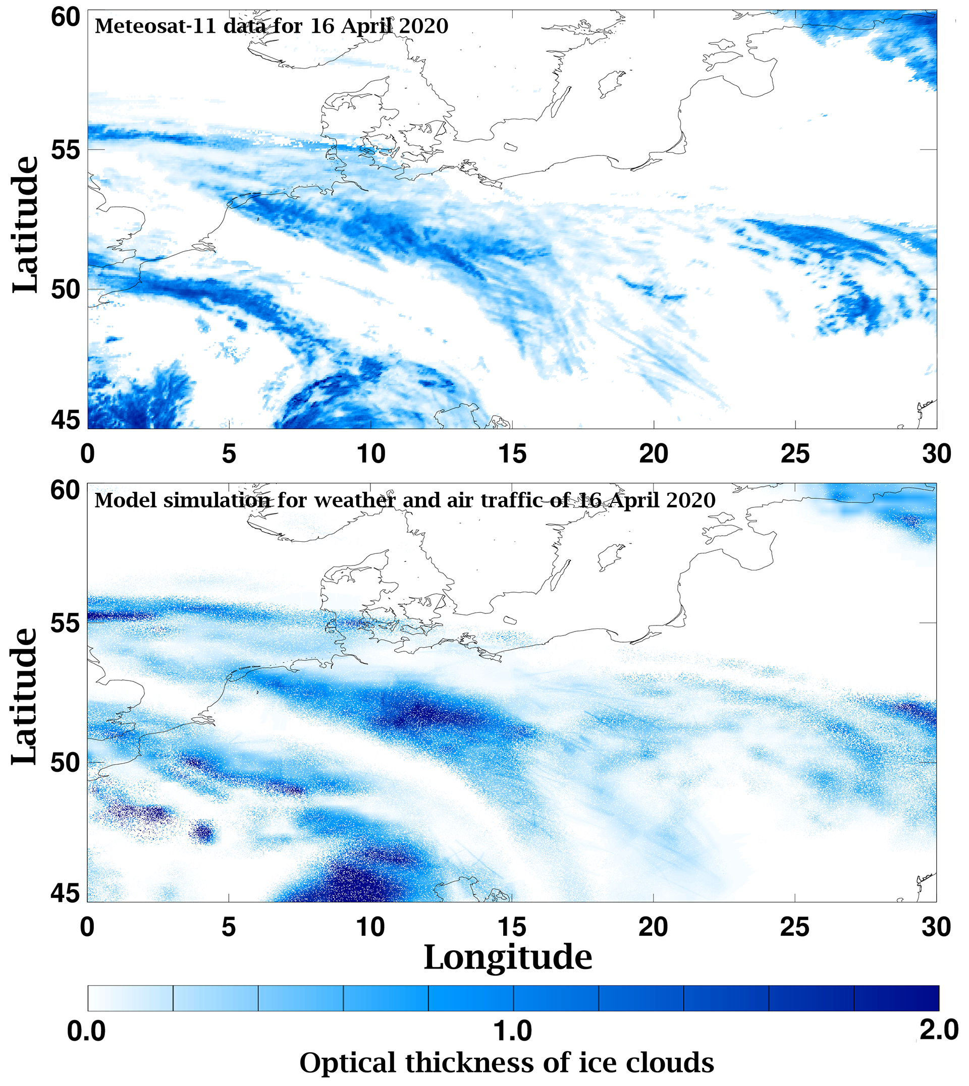
The images show the optical thickness of ice clouds derived from Meteosat-11 satellite data for weather and air traffic on 16 April 2020, 12:00 CET (top) compared to the modelled optical thickness of cirrus clouds and contrails for weather and air traffic at the same time. Satellite observation and model calculations agree. The optical thicknesses of the ice clouds were simulated with the contrail and cirrus model CoCiP.