3D view of Ascuris Planum in the Tempe Terra region


3D view of Ascuris Planum in the Tempe Terra region
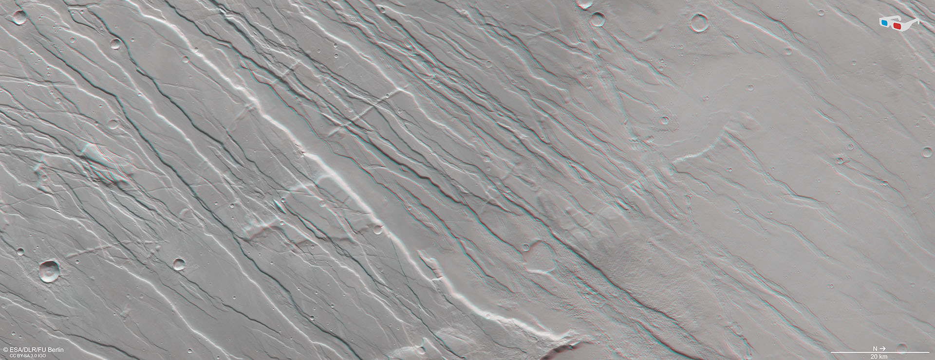
Anaglyph images can be generated using data acquired by the nadir channel of the High Resolution Camera System (HRSC), which is directed perpendicularly to the surface of Mars, and one of the four obliquely viewing stereo channels. When using red-blue or red-green glasses, they provide a realistic, three-dimensional view of the landscape. North is on the right of the image. The variations in altitude in this landscape, which is called a horst and graben structure, are striking. They range from several hundred metres to almost one kilometre. The grabens are the result of subsiding crustal blocks caused by stretching of the Martian crust. The terrain blocks left between the grabens are called horsts.