Topographic image map of the tectonic structures of Ascuris Planum

Topographic image map of the tectonic structures of Ascuris Planum
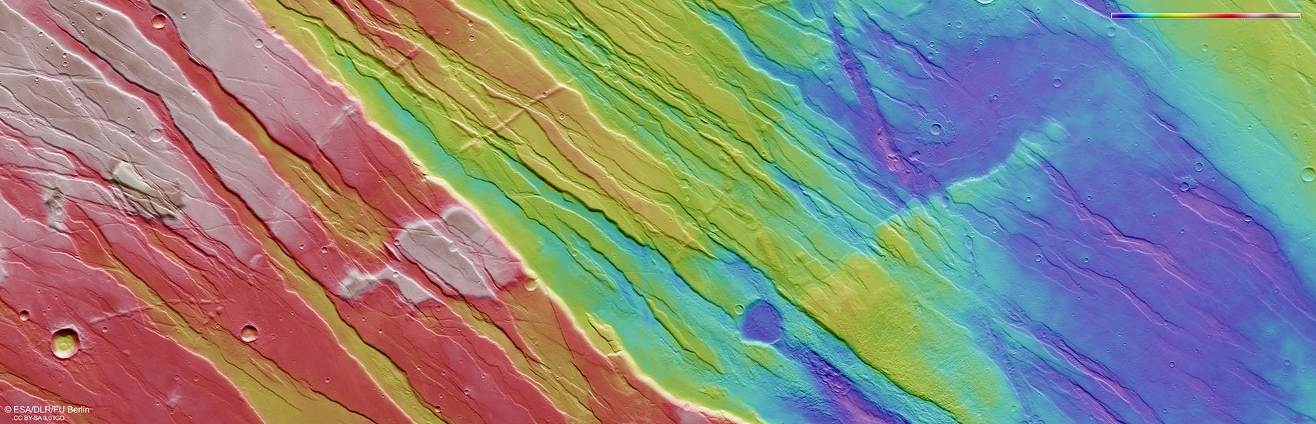
Using image strips acquired by the High Resolution HRSC camera system on Mars Express, which were imaged from different angles, researchers from DLR and Freie Universität Berlin have computed Digital Terrain Models (DTMs) of the Martian surface, which contain elevation information for each pixel. The colour coding of the DTM (legend in the top right-hand corner) provides information about differences in altitude in Ascuris Planum, the northernmost part of the Tempe Terra region. The model artificially highlights the horst and graben structure, which is the result of tectonic stress processes. When these processes occur, crustal blocks subside by several hundred metres down steep, almost vertical fracture surfaces, and grabens form between the remaining horsts. Some smaller graben fractures, which cut the prevailing stress regime diagonally, evidence a change in the direction of action of the subsurface forces.