The Mars 2020 landing site in the HRSC terrain model

The Mars 2020 landing site in the HRSC terrain model
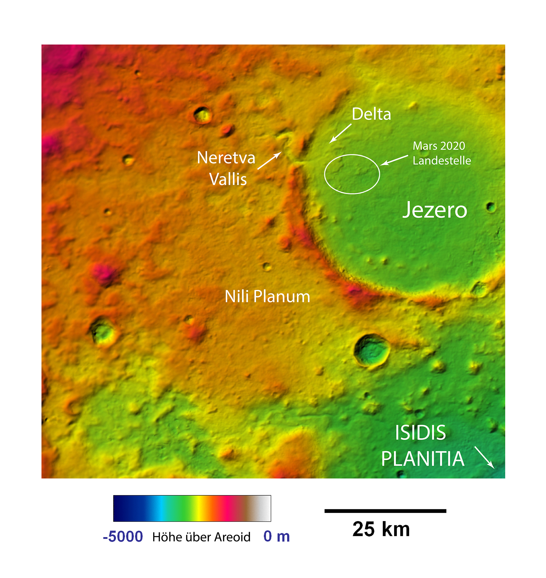
Since 2004, the DLR-operated High Resolution Stereo Camera (HRSC) has been acquiring high-resolution, colour and 3D photographs of Mars on board the ESA Mars Express spacecraft. The digital terrain models calculated from these images support the selection of the landing site and the development of the navigation systems for the landing of the Mars 2020 mission. The image shows the topography of the approximately 45-kilometre-diameter crater Jezero, its crater rim, which is about 1000 metres high, and the plain of Nili Planum. The NASA rover Perseverance is scheduled to land in the ellipse.