Vertical plan view – part of Nereidum Montes in true colour


Vertical plan view – part of Nereidum Montes in true colour
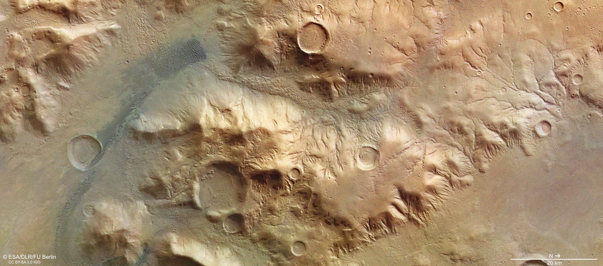
This vertical plan view of an approximately 130- by 60-kilometre area of Nereidum Montes – corresponding to an area roughly half the mountainous Austrian state of Tirol – clearly shows how the landscape at the crater edge has been shaped by various geological processes since the formation of the Argyre impact basin four billion years ago. Water, ice (both on and beneath the surface) and, more recently, wind have all left their mark. A striking network of small, branching valleys on the right-hand side of the image attests to water having flowed over the surface from the 4000-metre-high edge of Argyre and down the mountain slopes into the basin, carving out erosion gullies and creating small valleys.