ZKI damage mapping after the explosion in Beirut on 4 August 2020


ZKI damage mapping after the explosion in Beirut on 4 August 2020
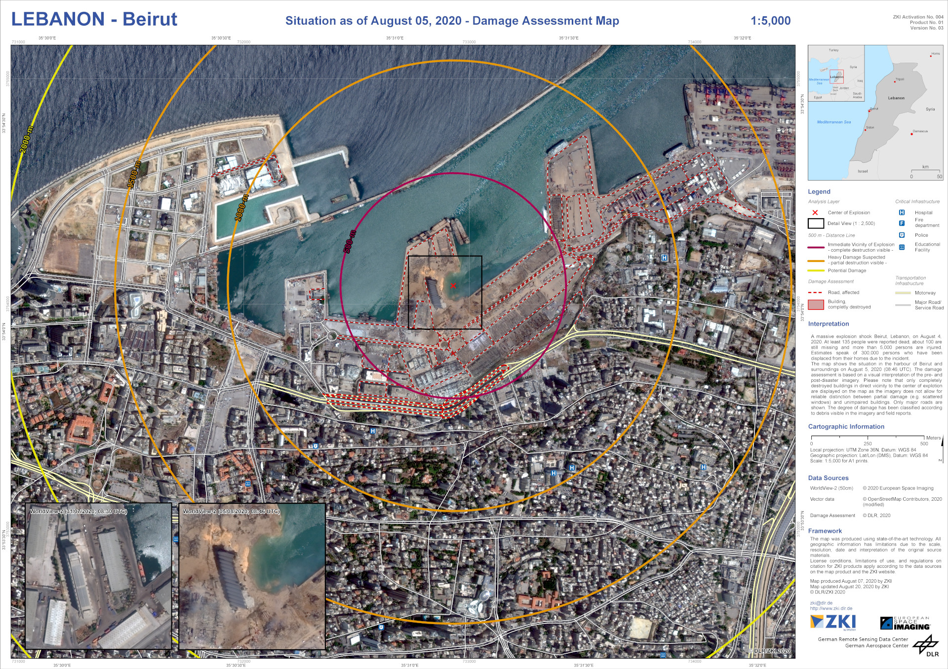
The mapping was undertaken using two optical, very high-resolution satellite images provided by EUSI (https://www.euspaceimaging.com/). The 'before' image was acquired on 31 July 2020 and was used as the basis for building mapping. The 'after' image was acquired one day after the explosion (5 August 2020). This image is shown in the ZKI map. The map shows the outlines of the buildings that were completely destroyed in the immediate vicinity of the explosion, as well as major roads, with an assessment of the damage incurred. In addition, the map shows facilities considered to be critical infrastructure. For better orientation, distance rings have been added to show the distance from the location of the explosion.