Topographic map of a crater triplet in Noachis Terra

Topographic map of a crater triplet in Noachis Terra
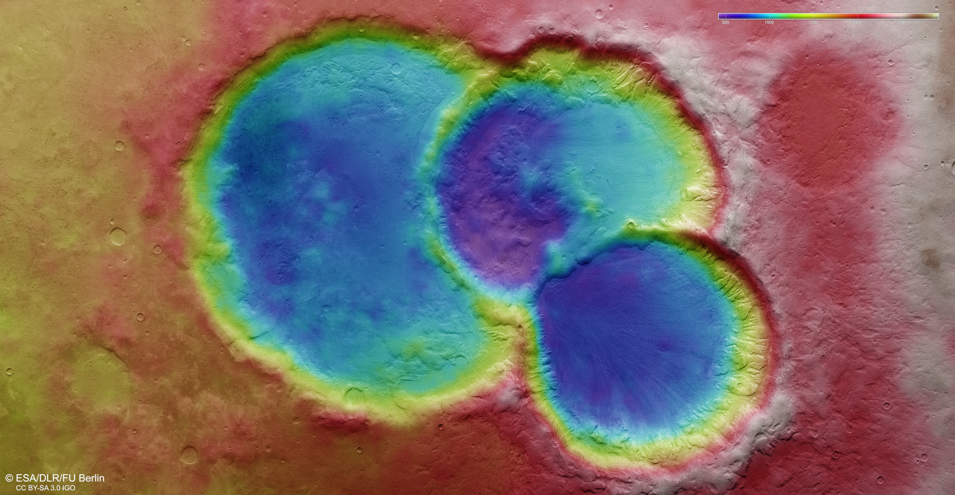
Scientists from DLR and Freie Universität Berlin compute digital terrain models from image strips of the surface on Mars, acquired from different angles by the High Resolution Stereo Camera (HRSC) on board Mars Express. In this process, height information is assigned to every pixel. The colour coding of the digital terrain model (see key at top right) provides information about height differences in this crater triplet, which lies to the east of the Le Verrier crater. North is to the right of the image. This shows that the three craters represent depressions in the Martian highlands that are more than 1500 metres deep, despite clear signs of advanced erosion – evidenced by the crater rims rising only slightly above the surrounding plain. Sediments have filled all three craters – originally, they had a depth of three to four thousand metres from the crater rim to the centre of the crater depression.